Posted: October 24th, 2006 | No Comments »
Lately, Adam Greenfield has been an easily trackable with blog posts and IM pointers locating his multiple appearances and talks. In July of this year he willingly left a web trace in form of an inspiring talk on everyware at the Keio University in Japan. Following the structure of his book he covers the definiton of ubiquitous computing, the current applications (mention to the Body Media SenseWear), the dangerous potential shift from user to subjet of ubiquitous environments and his design principles of ethical development of ubiquitous computing to prevent it.

Adam, a while before saying “I personally think a trained seal could design a web site”.
Relation to my thesis: Adam’s principles of ethical development of ubiquitous computing (self-discolsure, optional seamlessness, not introduce undue complication into ordinary operation, “graceful degradation”, we’re not very good at doing “smart” ) are at the core of my design ideas of location-aware systems. I look forward to meet Adam at the upcoming Lift Conference.
Posted: October 22nd, 2006 | No Comments »
IEEE Pervasive Computing released a special issue on Intelligent Transportation. Article of interest for my work include:
Eyal de Lara, Keith Farkas, “New Products,” IEEE Pervasive Computing, vol. 5, no. 4, pp. 12-14, Oct-Dec, 2006. Makes an introduction ton IntelliOne.
Anthony D. Joseph, Alastair R. Beresford, Jean Bacon, David N. Cottingham, Jonathan J. Davies, Brian D. Jones, Haitao Guo, Wei Guan, Yong Lin, Houbing Song, Liviu Iftode, Simone Fuchs, Bernhard Lamprecht, Kyandoghere Kyamakya, Jorge González Fernández, Juan Carlos Yelmo García, Yod Samuel Martín García, Jorge de Gracia Santos, Milind Nimesh, Gang Pan, Zhaohui Wu, Qing Wu, Zhenyu Shan, Jie Sun, Jian Lu, Guoqing Yang, Muhammad Khurram Khan, Jiashu Zhang, “Intelligent Transportation Systems,” IEEE Pervasive Computing, vol. 5, no. 4, pp. 63-67, Oct-Dec, 2006. Mentions 10 projects that deal with traffic and vehicular data collection, transmission, and analysis.
Jonathan J. Davies, Alastair R. Beresford, Andy Hopper, “Scalable, Distributed, Real-Time Map Generation,” IEEE Pervasive Computing, vol. 5, no. 4, pp. 47-54, Oct-Dec, 2006. Relates on the challenges of deploying an application that automatically generates up-to-date digital road maps based on the collection and processing of vehicles’ location data.
Relation to my thesis: Articles for my latest interest on transportation data collection in urban environment.
Posted: October 19th, 2006 | 1 Comment »
Urban Mapping produces multi-layered tourist maps called Panamap. These maps aim at improving the tourist navigation in a urban space by viewing only relevant information.

Images are interlaced by alternating horizontal strips from each. The resulting compound image is calibrated to a specially designed polymer lens substrate. By rotating the map, the angle of viewing is changed and one of the resulting three layers can be viewed


Relation to my thesis: I am wondering in what ways this layered view improves the spatial navigation. This is a good inspiration for an experiment that would display uncertainty (quality/timeliness) of the location data in a layered manner and evaluated if it improves the awareness or the navigation.
Posted: October 17th, 2006 | 4 Comments »
FortiusOne is about to release (with an API trial key) their GeoIQ API that works on top of the Google Maps API. GeoIQ should provide the geographic analysis facilities that Google Maps lacks. Their first idea has been to integrate their heat mapping API. In their blog, they provide an example of heat maps of traffic congestion based on the US Bureau of Transportation Statistics.

A comparison of the concentration of traffic delay in San Francisco and Los Angeles. The GeoIQ API creates a heat map based on an index that measures the amount of traffic delay on the roads and how closely that road delay is located to other delayed roads.
Update: the beta of GeoIQ is now available.
Relation to my thesis: “Democratization” of geographic analysis methods?
Posted: October 16th, 2006 | No Comments »
The last 40 days, I sadly increased my contribution to global warming in releasing NOx, CO, HC and SO2 to propel me around Europe and California. Below I try to compare the “geotraces” I left using (semi-implicitly) Plazes and (implicitly) Flickr. I generate the Plazes’ traces using Pascal’s jplazes.


Relation to my thesis: I am interested in the use of implicitly and explicitly collected “geotraces”. More specifically I would like to understand what level of quality/granualrity of the location information users need (when and in what context). and their visualizations.
Currently, Paul is running a little experiment on tracking his days. I aim at similar little side experiment with the daily use of a GlobalSat BT338 and GSM cell-id based positioning. The purpose here is to understand the potential of implicit trace generation with behavior inference based on location data.
Posted: October 11th, 2006 | No Comments »
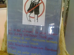
to write my research plan in the highly urbanized yet Internet-free Benidorm.

Posted: October 10th, 2006 | 1 Comment »
GPS systems has been used for several years by blinds and visually impaired people to raise their confidence in the ability to travel. Some coin it as “one of the most significant changes to a blind person’s mobility“. GPS complements existing aids. It could never replace a guide dog or white cane. Indeed, GPS can’t help getting around construction or the two-by-four sticking off the back of a truck. However, it fills in the blanks for a blind traveler on what they can find in an unfamiliar town. An example is Humanware’s Trekker. Input is done with an integrated tactile keyboard. Directions are given by a synthetic voice. Audio output was a design challenge, because blind people use their hearing to pick up subtle environmental sounds, and they also use high frequencies to detect surfaces (echolocation). A video of the Trekker is available here.
Update: Technology review has an article on Georgia Tech’s System for Wearable Audio Navigation (SWAN). (via Anthony Townsend)
Relation to my thesis: It seems that a navigation system, more than delivering directions, provide confidence to their users (not exclusively blind people) in unfamiliar environments. Humans use “echolocation” to detect their environment.
Posted: October 9th, 2006 | No Comments »
Ricardo Morla (PhD from Lancaster University, now post-doc researcher at UC Irvine), who I met in front of my poster at this year’s Ubicomp, will give a talk on Friday at the Laboratory for Ubiquitous Computing and Interaction, IC Irvine on the Interference in Deployed Ubiquitous Computing Systems.
Abstract: Future ubiquitous computing environments are likely to consist of numerous interacting components, many of which will have been developed in isolation from each other. Unless appropriate measures are taken, interference (where a component’s behaviour in a deployed system differs from its behaviour when in isolation) is likely to be commonplace. In this talk I will discuss the problem of interference in future ubiquitous computing systems and how it can affect many levels of a ubicomp system and be a concern for all ubicomp developers – ranging from those working on hardware and system support to those developing interfaces for user interaction and models of user understanding. I will also present two contributions that provide support for researchers addressing issues of interference in their systems. The first is a conceptual framework that includes a model of interference and generic solutions for preventing interference; the second is a simulation-based toolkit for helping researchers test their applications for interference prior to deployment. Finally, I will show the results of a formative evaluation that we conducted for informing the design of future user studies on conceptual interference frameworks.
Key references to Ricardo Morla’s work during his PhD thesis include:
Ricardo Morla, Nigel Davies. A Framework for Describing Interference in Ubiquitous Computing Environments. PerCom’06 – Fourth Annual IEEE International Conference on Pervasive Computing and Communications, Pisa, Italy, March 2006.
and
Ricardo Morla, Nigel Davies. Evaluating a Location-Based Application: A Hybrid Test and Simulation Environment. IEEE Pervasive Computing, 3(3):48-56, July 2004.
Relation to my thesis: Interferences are part of real-world (non-isolated) ubiquitous settings. This talk goes in the direction of a paper I plan to write on the design and deployment issues designers and administrators of pervasive games must deal with.
Posted: October 6th, 2006 | No Comments »
For a TenCompetence project meeting. One aspect of the WP I am involved with deals with the visualization of positioning and navigation within an information system (e.g. a competence development program). I am curious to see how some approaches can be mapped to location-aware systems.
On a side note, I always fin fascinating the struggle of using WiFi in conferences. The constraints are not only technological but also on the way the technology is deployed. Here, breakdowns were due to password-based access restriction with individual passwords, closed protocols (e.g. no VPN), uneven bandwidth, and even a power shortage.
Posted: October 4th, 2006 | No Comments »
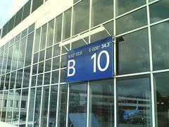
Frankfurt airport


