Posted: February 20th, 2009 | No Comments »
Shoval, N. (2007). Sensing human society. Environment and Planning B: Planning and Design, 34:191–195.
In this paper Noam Shoval proposes referring to the possibility of the aggregative use of cell phone spatial data as human sensing. He makes the distinction with remote sensing that applies more to the domain of physical geography arguing that human sensing enables us to sense people directly, in contrast to remote sensing, where the information obtained regarding human activity is indirect. Even if new sources of physical geographic data is related to aspects of human spatial activity, none of them can be thought of as materially augmenting more traditional social scientific data that describe the social characteristics of individuals and groups. Now the emergence of human sensing coupled with the considerable progress in the field of GIS, currently places us on the verge of a veritable revolution in human time-space activity research.
The author introduces the two methods of analysis of location data of cell phone that I have explored in the course of my thesis. First from the activity of devices that are associated with each antenna of the network during a certain period of time. Second, the detection of the location and migration of devices over a given period of time on the different antennas of the networks. Both approaches raise privacy issues, even though Noam mentions that “the data derive from statistics regarding activity in antennas and not regarding the locations of the phones themselvesötherefore there should not be any privacy considerations in this case”, comparing the approach to study census data for which “detailed census records at the individual household level are not usually available to researchers. Data are available only in aggregated forms at a level of detail intended to prevent the ready association of demographic information with individual households.”
Other challenges confirms the limitations that have emerged from my thesis works: a) aggregated cellphone data are particularly difficult to deal with high-resolution
interurban analysis; being more appropriate for studies of relatively low geo-graphical resolution, such as at the metropolitan level b) the representativeness of the cellphone data than necessitate calibration methods (although such issues must be addressed in any other research method as well)
Interestingly, Noam suggests the observation cellular network infrastructure already reveals general idea about the main nodes of activity in cities, such as concentrations of business activities, shopping, and leisure, such as here for Manhattan:

Image courtesy of Noam Shoval (original), created by Adi Ben-Nun from the Hebrew University GIS Centre, of a density map of around 1300 cellular antennas in Manhattan.
Relation to my thesis: “Time will tell whether the contribution made to human geography and the social sciences with this methodology will be on a par with the revolution generated by remote sensing in the field of physical geography and related geosciences.“
Posted: February 19th, 2009 | No Comments »
The 6th edition of the Digital Cities workshop series, organized by Marcus Foth will discuss urban informatics systems that provide real-time tools for examining the real-time city, to picture the invisible and to zoom into a fine-grained resolution of urban environments that reveal the depth and contextual nuances of urban metabolism processes at work. Particularly, participants will engage in discussing the research approaches that can differentiate (and break apart) a universally applicable model of ‘The City’ by being sensitive to individual circumstances, local characteristics and socio-cultural contexts, leading to the development of a toolbox of what could be termed anthropological urban anatomy. This toolbox would aim at better understanding the ‘city’ as an organism needs to help understand “how do the cells of the city cluster to form tissue and organs, and how do various systems communicate and interact with each other? And, recognising that we ourselves are cells living in cities as active agents, how do we evaluate the effectiveness and efficiency of the processes we observe in order to plan, design and develop more livable cities?“
Posted: February 19th, 2009 | No Comments »
The Digital Cities: London´s Future exhibition and series of events (Digital Tools for Urban Design and Virtual Tools for Creating our Built Environment) are coming to and end leaving an online catalogue behind them. The tools and techniques for planning, organisation and governance of showcased in London’s Future reveals a fascination for the digital geographical data and 3D models that seems to completely overshadow the human and social layers of the digital cities. For instance, the catalogue on Digital Cities: data and democracy contains only a couple of images with actual human being and one of them to featuring “people watching” as an example of human interaction with the physical phenomenon of our city. Sigh.
Relation to my thesis: There are certainly additional tools and techniques that help planners and designers exploit the resources of digital cities.
Posted: February 18th, 2009 | No Comments »
The Lift workshop on The Design of the Hybrid City of the Near Future that I co-organize next week with Nicolas Nova and Daniel Kaplan has now reached its limit of 24 participants. It will gather a pretty exciting matrix of m(researchers, designers, and thinkers) x n(students, professionals and entrepreneurs) to discussion new ideas, experiments and theories around the design of the city in the urban informatics era. Particularly, it will focus on extracting and critic the main transformation in design processes implied by the emergence of a) new urban actors (digital infrastructures, citizens as sensors, Google, online social networks), b) new urban interactions (real-time awareness of flows, access to shared resources, automated access, mobile access to geoinformation) and c) new practitioners practices (novel access to information on the society that make the city, its people, networks, culture).
We will engage the discussions on themes based on generic visions of the hybrid city of the near future (e.g. a bottom-up city, a zero-emission city, a sentient city, a city that bonds people) and try to extract
- their key factors for success and failures;
- the concrete first steps to aim for success;
- the difficulties to integrate these steps into current practices
- the implications to the design of these visions (examples and counter-examples)
- elements to prevent us from regretting the contemporary analog cities
See you at Lift!

Posted: February 3rd, 2009 | 1 Comment »
Within the spirit of 2007′s Embracing the Real World’s Messiness and 2008′s Sliding Friction, the plan to install GPS-ready bus tracking equipment to New York City buses has been pushed off indefinitely.
It’s a project that was supposed to revolutionize bus travel, telling riders exactly how long ’till the next bus, and allowing them to see the exact location of buses in real time, whether on the Internet or on a handheld device. But at a City Council oversight hearing Thursday, MTA officials said ‘forget about it’ and have officially abandoned the project, to the disbelief of lawmakers.”
“‘It’s just incredible that in this day and age, we’re nowhere closer to being able to know where the buses are at any given point,’ said Queens Councilman John Liu.”
“Under a contract awarded in 2005, tracking equipment was installed onboard 185 Manhattan buses. In August of 2007, screens began operating in test mode, but were turned off a few months later because the times were inaccurate. They’ve been dark ever since.”
Source: Planetizen
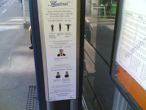
The workaround? Bus stop relaxation! (in Zürich)
Relation to my thesis: Cities Are All About Difficulty
Posted: February 3rd, 2009 | No Comments »
Martin Dodge‘s latest talk on “A New Countryside Code? Software, Surveillance, Simulation of Rural Spaces“, takes us away from the socio-technological considerations of pervasive computing in urban environments to make observations of his concept of code/space in the rural context, looking at “What difference does code make in the countryside, particularly in farming practices and rural landscape“. Beyond the ‘techno-hype’ the pieces about distributed sensor nets on farms and bio-instrumentation of livestock, the contemporary country has rarely been observed through social-technical lenses. Contradicting the general assumptions that oppose the rural with the urban and the modern, farm spaces are highly surveilled and governed (e.g. to track bird flu outbreaks). The integration of software in the countryside makes farming knowable, abstracting animals and changing practices with a stock person becoming a screen-worker. The ability to code livestock and the agricultural land creates new types of surveillance with “the data needed to drive them can be obtained without any knowledge of those to whom the data pertain” and new opportunities to simulate risks. This evolution raises questions on the dependency of farms on software and the effectiveness of their promises:
But how far are some farm spaces now code/space? are coming to depend on software and distributed information systems to function?
What is the effectiveness of real-time surveillance and potency of future predicting software simulations for managing rural landscapes?
Walking through the contemporary Spanish rural code/space over the weekend, capturing what Martin Dodge would describe “green and pleasant landscape mixing with the obvious technological infrastructures and grey concrete”

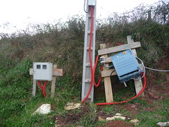
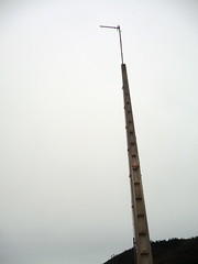
Relation to my thesis: Healthy exercise to observe the socio-technical implication of pervasive computing outside of the city, comparing, rather than opposing with other environments, the rural context with its need of surveillance, governance and predictions, with digital data and software that change the practices and expectations. Juan Freire researcher in marin biology also performed this kind of exercise that draws comparisons between the ocean and the city and their digital skins (see his presentation at Visualizar: Visualizing Urban Spaces’ Digital Skin. How? Why?)