Posted: May 30th, 2007 | No Comments »
My work-in-progress submission (co-authored with Nicolas) entitled “Tracing the Visitor’s Eye: Using Explicitly Disclosed Location Information for Urban Analysis” has been accepted for publication in the July-Sept. IEEE Pervasive Computing special issue on urban computing. The call for paper was here. With in addition my two weeks stay the MIT Department of Urban Studies and Planning to deliver a proof of concept, the project is now well alive and kicking.
Posted: May 24th, 2007 | No Comments »
Today, I presented to the SENSEable City Lab team my past projects and my line of research on location-awarness at the crossroad of ubicomp, HCI and urban studies. This purpose was to provide a rather detailed awareness of my research agenda to maybe find synergies for the future. The slides and notes are available here.

The feedbacks were rather positive with many questions and discussions around the shift from location-based services and location-enhanced services (e.g. location is not at the center of attention). Carlo Ratti questioned the overall coherence of my different studies. For example, he was puzzled by the case study of a study of a system such as Flickr, designed by somebody else to then evaluated my own design in the field. I am aware (and concerned) that I will need to find relations between studies, but so far the several advisors who have seen my work at CHI and Pervasive confirmed me that if was fine. However, I surely will need to find a stronger focus (e.g. study of one/two specific spatial activity) and define the audience and part of the system (e.g. interface visualization, interaction, middleware) I would like to influence. My claim is that I am in a funnel and that this summer case studies will lead me to study and evaluate more specific issues as the one I described today.
Posted: May 21st, 2007 | 1 Comment »
 As part of my Tracing the Visitor’s Eye project, I am currently visiting the SENSEable City Lab to work on innovative approaches to describe tourist dynamics in cities. Instead of relying on the deployment of ad hoc infrastructure, the solutions will favor the collection and analysis of both explicitly and implicitly disclosed people-generated geolocated information. In parallel, we will work on scenarios of location and time sensitive information delivery to enhance the tourist experience. I hope to set the emphasis for later implementation on the socio-technical implications for the design and deployment these types of applications.
Analysis of the tourist dynamics
I observe Flickr as a contemporary open platform where location and time sensitive data can be uploaded and accessed (mainly from an historical, archiving, awareness, sociality functions). The platform offers news approaches to collect data revealing patterns of tourists and their usage of a city (points of interests) and a region (flow between urban and natural attractions). In details, it means:
- Reveal temporal signatures: activity by day-of-week, weekdays and weekends, seasons, periods.
- Characterize people: Difference in the traces left by locals and visitors
- Characterize the types of visits: where a tourist converging over the course of their visit (how many days, how far, how dense (i.e. amount of different visits per day)
- Visualize the flow with origin and destination (city, region and world level)
- Characterize the areas of the city/region: where are the concentration of tourists? Cluster analysis to define or characterize zones (define a composite signature).
- Define points of interests: which landmarks attract more people
Enhancement of tourist experience
The study of the use of the granularity feature ) can help defining the level of location information quality and timeliness to be delivered in the design of useful and relevant urban location-aware applications. Moreover, it can help framing approaches the access and delivery of information to tourists owning mobile (cellphone) and nomadic (notebooks) devices. How to perform a field study to evaluate if the tools to enhance a tourist experience allow making more informed decisions. This might not be covered in the scope of these 2 weeks, but it surely would be good to define some next steps.
Expected outcome
- An extended abstract to be submitted as late-breaking results for UbiComp07. As part of the study I perform here. I use the context and tools of the analyis of the tourist dynamics to study how people upload and explicitly disclose geolocated information and how they retrieve/access it. My hypothesis is that the level of location information quality and timeliness to be delivered can help a designer to provide useful and relevant urban location-aware applications.
- Report on the results of the proof of concept of the using Flickr as source for tourist dynamic analysis. I should focus on the results, the limitations and the possible other approaches and convergence of data.
- Scenarios on the delivery of location sensitive information to tourists
Relation to my thesis: Exploring the context of my flickr case study and more importantly my last city-scale field experiment.
Posted: May 19th, 2007 | No Comments »
My unstructured take-aways from this week’s Pervasive conference in Toronto.
Doctoral Colloquium
I presented a shortened (10min+20min discussion) version of the talk I gave at CHI. I received more or less the similar feedback as in the review of the submitted paper and at CHI in San Jose. I was once again encouraged to take advantage of my engineering skills and interests for the human side of technology. The new suggestions consist in considering the relation between designers-developers-users. That is make them aware of the uncertainty. The analysis of the user behaviors could both the engineering and interface design of location-aware applications. I could help designer think about all the possible issues for the design. It could maybe take the form of a systematic approach on the issues described in the CMPPC workshop paper).
The faculty advisors were: Albrecht Schmidt (Ludwig-Maximilians-University Munich), Mike Hazas (Lancaster University), Tom Rodden (University of Nottingham), Marc Langheinrich (ETHZ), Boriana Koleva (University of Nottingham), Rene Mayrhofer (Lancaster University), and Gerd Kortuem (Lancaster University). The slide and notes of my presentation are available here.

Probably the last of my “bridging social-technical gap” serie of presentation. Time to move forward and act.
Scrutability
In his talk on PersonisAD: Distributed, Active, Scrutable Model Framework for Context-Aware Services, Mark Assad (The University of Sydney, AU) mentioned the concept of scrutability (i.e. make the what and why of context visible). For a scrutable application should be able to reveal the user what sensor detected him/her and for what reason (activity, location, movement). Scrutablity is extremely relevant to the “self-disclosing” design principal mentioned by Adam Greenfield in his keynote speech earlier that day.
scru·ta·ble (skrt-bl) adj. Capable of being understood through study and observation; comprehensible.
Authoring tools for location-based applications
Leif Opperman presented his research on facilitating the authoring of location-based applications. He has been running a first set of experiment that let artists use his authoring tools for location-based applications. He uses an ethnographic approach to study of displaying the ubiquitous infrastructure and the uncertainty of positioning and communication influence the work of the artist. Previously, he had been developing games on top of the Mobile Bristol Toolkit which has been released this week under the name of MScapers. InternetActu reported on the release. Apparently, Barcelona has been the stage of a mediscape game.

Source: Leif’s UbiComp 2006 paper Extending Authoring Tools for Location-Aware Applications with an Infrastructure Visualization Layer.
Usefulness and relevance
In his talk on the paper An Exploration into Activity-Informed Physical Advertising Using PEST, Matthias Sala showed a graph comparing the usefulness and the relevance of information (the sweet spot being when the 2 converge). Since I sometimes mix these terms when talking about the delivery of location information, it is important that I go back to the definition:
Usefulness: Having a beneficial use; Being of practical use
Relevance: Pertinence to the matter at hand
Team awareness and wearable computing
Andrew Vande Moere presented a work on wearable visualization with a study based on the hypothesis that awareness will change how people play: “Evaluating a Wearable Display Jersey for Augmenting Team Sports Awareness”. I was most interested in the user-centered approach in the design of TeamAwear: 1. evaluating ethnography, 2. participatory design I, 3. participatory design II, 4. usability evaluation.
Replay tool
Alistair Morrison presented further work on the University of Glasgow’s Replayer used to perform both qualitative and quantiative analysis for the evaluation of pervasive systems. Using Location, Bearing and Motion Data to Filter Video and System Logs.
Spatial cloaking
In his talk, John Krumm mentioned spatial cloaking as a way to increase the privacy from the analysis of location tracking. Spatial cloaking consists in revealing spatial coordinates with less accuracy. Similarly, temporal cloaking reducing the accuracy in time. Related to that, I stumbled on Anonymous Usage of Location-Based Services Through Spatial and Temporal Cloaking that differentiate location-based services aong the dimensions of frequency of access, time-accuracy and position accuracy:

In the introduction of the subject of his talk/paper “Inference Attacks on Location Tracks” John mentioned that people concern in privacy emerge in the trade-off between usefulness (how much people would pay) and risk.
Digital footprints and exposure awareness
In Virtual Walls: Protecting Digital Privacy in Pervasive Environments, Apu Kapadia introduced the concept of
exposure awareness with the example of an environment that give the people the information about how much information they expose. By deploying “virtual walls,” people can control the privacy of their digital footprints much in the same way they control their privacy in the physical world. Once again a design approach to reveal the systems following Adam Greenfield’s self-disclosing principal and very similar to the concept of scrutability.
Middlewares for context aware computing
I bumped into Mike Blackstock who very briefly introduced me to the current works in the field of middleware supporting context-awareness and most specifically the Java Context-Aware Framework and the PerCom workshop CoMoRea. Later, in chating with Paddy Nixon, it seems clear that:
a. interaction design may impact the implementation of the middleware systems,
b. uncertainty is rarely (if not never) taken into consideration and it is still a challenge.
Location-update strategies
In Zone-based RSS Reporting for Location Fingerprinting, Mikkel Baun Kjærgaard introduced a list of Location-update strategies I could use later (similar to Leonhardi’s A Comparison of Protocols for Updating Location Information. Strangely, the type of user-context generated update was not mentioned.
Tutorials
The day of tutorials lead the participants through all the layers that make pervasive computing a thriving research domain: sensors, location awareness, context awareness, machine learning, middleware systems, interaction, evaluation, ethnography. I recorded most of the lectures.
Tom Rodden introduced the issues in dealing with both the technical and human perspectives of pervasive computing. The HCI approach is about rethinking and reconsider the notion of context, or the human nature of the context. He showed a couple of videos of pervasive systems such as the Stanford i-Room artificially situated within a lab. He argued for more research work more situated in the real world, in every day, because the best way to test the use of such technologies is to make them leave the laboratory. The role is HCI is also to reveal the kind of interaction we can make emerge. Tom talked about “new value systems” with example of subtle interactive and ambient with a refreshing touch of english-humor. A video of the Key Table (video)was without a doubt the most surprising. This definitively goes into the trend of chili computing. The Drift Table (video) was another example

Paul Dourish and Ken Anderson went through the historical periods and transformation in the practices of ethnography to later reflect on they way we use this method today. This lecture was an extension of Paul’s Implications for Design as they described ethnography’s prime goal to write about people and not about trying to fix things (i.e. implication for design). More than understanding what people do, an ethnographic study analyzes how people think/the rationality/conceptual breakdowns. In other words, it aims at understanding people’s conceptual thinking. It is not necessarily the amount of data collected that counts for interpretation but rather it is very important to spot the “symptomes”.
I was absolutely not aware the the differences between emic and etic data to describe human behaviors.
Gregory Abowd argued that an evalutation of pervasive system needs both a technicaly savvy and evaluation savvy people. It is very rare to be good at the 2. There is a uniqueness in the evalution of ubicomp system. Because they take the world as laboratory and they need technology development in order to perfrom such evaluation. In other words, ubicomp helps ubicomp evaluation. An evaluation can be formative (part of the development process) or summative (e.g compare 2 applications). Of course, the exploratory work and the design approach of ubicomp makes some scientist think it is “soft”. However, ethnography and qualitative studies help bring rigor.
The evaluation work done by Gregory and his team made me think about what could be done in one of my real-world study. I could take their “beepers studies” as example to ask “where are you?” and questions about the awareness of the whereabouts.
Paddy Nixon refreshed my knowledge in distributed systems and middlware. He went through the approaches of event based distributed programming (publish-subsribe) and defended it and p2p for ubicomp rather than corba/jini (they make the bad assuptions of a perfect world, balancing the local vs. global). However, p2p has been about sharing and not efficiency. So far it has been extremely hard to build generic middleware systems for ubicomp
Interestedly, he mentioned that interaction design may impact the implementation of middleware systems and that uncertainty is still a challenge that nobody really started to tackle.
Anind Dey admited that the community does not try to model the entire world anymore (something that I heard at the DC as well… researchers have given up on over-infering and automate). Therefore now the goal is to understanding what people actually want and find the important pieces of context. Similarly to my talk at LIFT, he showed relevant examples of automatic doors and the difficulty notion of intentionality (i.e. The Amazing AutoDoor, Star Trek manually operated automatic door). Similarly, cleaning automatic doors has become a slow process (video).

Automation has an impact on cleaning. The door should understand that it is being cleaned?
Finally, representing uncertainty is still a challenge along with the balance between autonomy and control.
Posted: May 11th, 2007 | No Comments »
The written feedback I received for my accepted paper for the Pervasive 2007 Doctoral Colloquium are rather encouraging and reveal similar suggestions and advices given at CHI. My research focus and strategy is well grounded and accepted. One reviewer noticed that my work clearly starts where others (e.g. Benford, Chalmers) have stopped. However, now has come the time to be more specific on the methods to collect and analyze the data. Moreover, I still need to argument the ways I plan to evaluate the design strategies I will propose. I split the feedback as follow:
Scope
First my dissertation research is perceived has well grounded, well situated, and well motivated. My contribution would improve the state of the art. Yet, my early work is perceived as rather preliminary (very simple and obvious). Certaintly because a lot comes from the litterature that concures with what could be observed in CatchBob! Yet, I feel that I contributed into unifying the state of different domains such as context-aware computing, human-computer interaction, CSCW, urban computing, (humanistic) geography, geospatial visualization, transportation research to converge on the specific issue of spatial uncertainty. To my knowledge, the literature in location-aware computing and location-awareness has never profited from the ensemble of these different perspectives. My current contribution maybe lays more in that area, with my first field study acting as revelation and consolidator.
Research strategy
The approach of analyzing the current use of location information and then building and evaluating a location-aware system form an acceptable strategy. In addition, using location-based games has proved to be a feasible avenue of investigation. This strategy is a result of my overall motivation in this research. I believe it is important to study the pieces of the ubicomp of the present in their context and current us to understand how they can gradually be integrated at a larger scale. As a result, practically speaking, knowing how good in good enough in terms of location-awareness, can prevent the counterproductive aim for technological perfection.
Methods and data analysis
Now, how exactly will I tackle my research questions in a way that is not too expensive for a PhD. One reviewer mentions that two of the sub-questions might suffice for a good thesis. However, all this depends on the methods of investigation and support with the data analysis. For example, I might also pursue a collaboration within a larger project (this is my current intention).
Mixing field and case study seems fine, but I must be able to describe in greater details these two different approaches and the methods they imply. For instance, there is not clear definition of both approaches. My perception of a case study is that it is not controlled and very observational both from quantitative and qualitative data. On the other hand, a field study is more directed by the capture of the data from the variables to analyze. That implies a quasy-controlled environment propitious to targetted data collection and focused ethnography. A case study is a good way to explore behaviors and a field study allows to evaluate or demonstrate. Mention field experiment instead of field study for example. At this point I need much more thinking about collecting data and analizing it. Finally, while hard to accomplish and time/resource consuming triangulation of methods (mixed research) is always advisable. Therefore, I should find out which of the analysis methods suit best for my research question, resources (help from co-investigators? collaborate with social scientists) and abilities (improvement with supervision and training, reading about it is not enough).
I still lack of a clear strategy on how to exploit the results of my studies and how to transfer the experience into appropriate solutions/strategies for developing location-aware applications. How will I evaluate the new proposed strategies. I’ll get back to John Creswell’s Research Design over the weekend to help me iterate one more time over my intentions and how to answer the questions of each of my proposed study. Then I’ll need to articulate them as a whole.
Contribution
My preliminary work (while basic and somehow obvious) show that I can meet the research goals. However, I will need to be careful to the extend the results I claim can be generalized across domains (but I guess this is every PhD student’s problem in the field of HCI).
Related avenues to consider
The reviewers suggest avenues that I actually considered in the past, but did not mention in the paper for the sack of … They mention that I should have a look at the positive aspect of uncertainty. For example: How do people exploit uncertainty (keep privacy, location disclosure) and as a way to appropriate ambiguit for one’s one purposes (e.g. Bill Gaver’s Ambiguity as Resource for Design). I should look at how people experience space (or place). There is a good litterature on that in the domaine of “humanistic geography” (so far, I inspired more from the works of Rapper and Mountain… Time geography). So instead of going too much in geography (geometric measurement of space) I should be more aware of the experience and meaningfulness of space.
I could address the privacy issues in addition, with the demand of spatial uncertainty (privacy policites to cloaking). Not to deliver information about the intentional spatial uncertainty. I read a rather technical article (based on a middleware approach) on that recently: Efficiently managing location information with privacy requirements in Wi-Fi networks: a middleware approach. The ideal would be to impact the design and logic of the middleware from a human-centered perspective as Tom Rodden suggested me 2 weekends ago.
Next step: Provide an answer to these feedback in my DC presentation on Sunday. Try to explain more clearly the questions/methodology/data analysis for each study. Then define the outcome of each study to articulate a coherent whole. Iterate, and iterate more…
Posted: May 11th, 2007 | No Comments »

Exception handling: Traces of a misconnected flight on my checked-in luggage
Posted: May 11th, 2007 | 1 Comment »
Following up on the preliminary work to setup an ethnographic study of the use of GPS navigation systems by taxi drivers in Barcelona. I drilled the taxi driver who brought me to BCN El Prat airport at 5am this morning. He was at the end of his night shift. I started by trying to define his profile. He is very familiar with the city and has been a taxi driver for 7 months. He bought his GPS navigation system (that he did not use for this ride) with the taxi. While he admitted that GPS (he was saying “GPS” instead of “navigation system” does not come without problems (bad advises on navigation) and he considers it as a killer asset. When I encouraged him in telling me more about the necessity to be aware of his location and his whereabout, he detailed two different scenarios:
1. Reaching the specific destination
During the ride to a rather unknown destination (lack of precise mental model), he accesses the geospatial information as in a “funnel”. First, he checks in the paper-based guide of the city to know more or less the area he should direct to. In that area, he waits for a traffic light to type the exact address in the navigation system. He explained that he engages with the system at that moment to avoid the often misleading information on the path to take. Indeed, a taxi driver applies several paths depending on the time of the day and circumstances (e.g. traffic, weather conditions, recommendation of passenger). In fact, this specific taxi driver could name me the places where he experienced the navigation information to be absolutely irrelevant (e.g. get access to the forum area, plaza de Glories).
2. Getting back on tracks
A main problem for a taxi driver is to be lost after dropping off a customer. This often happens when the customers guide to the destination. Therefore, taxi drivers thrive on information to get back into known terrotory. That can be landmarks (e.g. a tall building), the topology (e.g. a mountain/hill). But getting a sense of orientation can easily become problematic (e.g. during nighttime or bad weather conditions when tall buildings and montains are not clearly visible). This is where the GPS comes handy. This specific taxi driver would ask the them to give him the way out by typing “plaza espana” (i.e. a large roundabout in the center of Barcelona).
From that informal, unstructured discussion, I tried to form a more detailed description on what I am looking for in the study (questions/hypothesis) and how to answer (methodology/data analyis)
What are the hypothesis/questions
- When is the system used? That is at when does the driver need it during a service (start, to complete the task, at a special event (find related information such as POI or hotel).
- Where is the syste used?: dense urban area, countryside, main roads, familiar zones, unknown remote areas.What kind of geoinformations are used by the drivers both from the system and from the environment (experience, radio, interaction with customer, context such as visibility to landmarks). First I am interested by the nature of the information (step-by-step navigation, real-time positioning with map to get a sense of the whereabouts, POI, dynamic data such as radars/traffic, time of the day. This actually reminds me of a taxi drivers who explained me that he essentially used GPS to relax. That is, he would forget about the names of the streets and the intersection (or count the number of the streets) because he could always fallback on his real-time position and act based on that. Second, I am interested to record how the drivers rely on these data/observations considering that some are uncertain.
- What type of view is used and when (top, titled (bird’s eye),.voice)? What is the preferred view (from part of the taxonomy for visualizing location-based information) depending on the specific tasks. That is to understand what views help disambiguate or support the awareness of the whereabouts.
- How does the co-evolution process unfolds? Maybe drivers can explain the evolution of their relation with the system. From the acquisition and setup to the point of clearly defining what the system can and cannot deliver. I am especially interested in knowing how the drivers learned the limitations of the system. How much the system can be trusted and what is the reaction when the quality is not met (awareness of the limitations/imperfections)
What is the methodology to collect data/record data
I plan 40-50 semi-structured interviews of taxi drivers at their waiting area in the BCN airport. I would then transform myself into a complete observer (focused ethnography) in about 10 rides of 30 minutes. field notes and photos of interaction. To be detailed more as I get more familiar with qualitative data collection. I should also be able to argument for that approach and not another. The BCN airport has a huge parking lot where taxis wait their turn. The minimum time is 1h. Taxi drivers take the opportunity to clean, walk, eat and play. I was confirmed it is a very good place to conduct survey with semi-structured questionnaires.

Taxis queuing area at Barcelona airport (often for more than 1 hour). The stage for semi-structured interviews. (photo courtesy of jpg)
How to conduct the data analysis
Coding: Categorize the unitary tasks (navigation (take decisions on the path), search destination, self-location awareness (positioning) of the taxi drivers and understand what type of geospatial information is applied for each. How are the limitations/uncertainty understood (if there are any), what was the evolution process as of defining the limits of the systems.
Next step: Maybe focus on 2-3 questions and define a set of leading questions to structure an interview. Try to grab Ken Anderson and/or Barry Brown at Pervasive to get some insights. I hope to get some more insights from the Ethnography, Thick and Thin tutorial on Wednesday.
Posted: May 10th, 2007 | 1 Comment »
Where I will attend and present my work at the Fifth International Conference on Pervasive Computing (Pervasive 2007) and integrate the MIT SENSEable City Lab for a 2 weeks stay as a visiting PhD student.
Posted: May 6th, 2007 | 2 Comments »
My unstructured take-aways from this year’s ACM/SIGCHI Conference.
Doctoral Consortium
Last weekend, I participated to the CHI 2007 Doctoral Consortium in San Jose. My presentation summarized the current state of my PhD thesis (problem statement, research questions, research strategy/approach, early observatory work) and layed-out the future steps (ongoing case study and future case and field studies, analysis methods). The slides and notes are available here.

The purpose of the doctoral consortium was to received feedback from five senior faculty members: Deborah Tatar (Virginia Tech), Tom Rodden (University of Nottingham), Wendy Mackay (INRIA), Gary Olson (University of Michigan), Batya Friedman (University of Washington). Beyond the suggestion to improve the students’ research work, they pointed out and helped identifying gaps and holes in our research. For example, they asked us to clearly present our contributions (e.g. How will your work be cited?).
My presentation received rather positive feedback. It was perceived as one of these rare piece of work that investigates the human and social use of technologies, with a deep understanding of the software engineering techniques. However, the faculty advised me to soon make a clear choice on the outcome of my work and the roads to take (“none can be wrong!”). For example, I was suggested to integrate into the middle-ware of a location-aware system, the evidences my case studies could reveal. It is actually a path I discussed a while ago with Paul Verschure. I could have a look the way autonomous systems take spatial uncertainty into consideration (like I did by discussing with Alex). Selecting the road might also come from defining the community I want to talk to: designers, ethnographers, ubicomp/technologists, … I partially answered to that when I was asked on the motivation of my work. I mentioned that I wanted to contribute to a human-centered approach to the design of ubicomp technologies (like I suggested previously). Finally, among other things (discussion on the benefits of uncertainty and on the study of location disclosure), the faculty encouraged me in performing my ethnographic study of taxi drivers (e.g. inspired by Andy Crabtree’s work for example). Nevertheless, I express my concerned about performing several unrelated studies. The approach seemed rather good, if the analysis methods are comparable.
The process of obtaining a PhD in HCI was also a major topic of discussion. I captured a few valuable advices:
- In the introduction of a dissertation, think about the different types of approaches in the audience and then elect one. However, even if you select an audience, make sure to be stay aware of the others.
- For example to feel the entire space of the research, select 5 different approaches to the questions I care about. Think of where do I get for each problem.
- At first, you can start with big claims, but as the research process goes on you must finish with precise claims.
- When defining a contribution rely on what to find out (how can we cite your work?), where does your heart lies, what do you care about.
- Eventually, the goal is to nail down some things and find a credibility
- There is danger i building a system assuming that people will use it. You do not want a thesis to rely on such a system.
- Get specific data first and then generalize
- Find people that you have good access to. For example consider approaching with your data different people with different approaches. Try to get perspective from the data. Do not only show the results, show the data.
- A thesis is very personal and is a narrative bringing discussion and reflexion, argumenting the claims
- Data are measure not observations. It describes the way to go about resolving the problem (which is already an achievement)
- Framework can be an empty work. Make sure to specify a framework for …. to …
Finally, it was a real pleasure to share time with cool cats Leah Findlater, David Holman, Christopher Frauenberger, David Akers, and others.
Relevant talks attended
Why We Tag: Motivations for Annotation in Mobile and Online Media (Morgan G. Ames)
Ethnographic study revealing a taxonomy of motivations for tagging photographs
Social Practices in Location-Based Collecting (Kenton O’Hara)
Focus on location information consumption (in sitiu vs. collecting).
Capturing, sharing, and using local place information (Pamela J. Ludford)
Spatial annotation system that triggers location-based reminders. Interestingly this work did not cover the problem of decay of location information (its timeliness).
Mapmover: a case study of design-oriented research into collective expression and constructed publics (Carl DiSalvo)
Might not agree on the analysis, but at least a research reporting on a failed project! The problem of such outcome is of course to be able to scientifically prove why things did not work.
Show me the way to Monte Carlo: density-based trajectory navigation (Steven Strachan)
Use of GPS and Monte Carlo sampling to build an eyes-free pedestrian navigation system. Talks about the issues on dealing with uncertainty in the GPS data.
Comparing physical, automatic and manual map rotation for pedestrian navigation, (Will Seager)
Field experiment to study the usability of 3 types of map alignment on a mobile device. The study provides strong evidence that physical rotation is the most effective with applications that present the user with a wider map. Most interesting to me, is the way the field experiment was conducted.
I already reported on the workshops Imaging the City and Mobile Spatial Interaction
Missed opportunities
Unfortunately, the day after, I could not attend the The Design of Spatial Applications workshop. Hopefully, I’ll be able to meet up with the instructor Matthew Hockenberry in a couple of weeks at the MIT. I also found out too late that Antti Oulasvirta and Matt Jones were around.
Posted: May 6th, 2007 | 2 Comments »
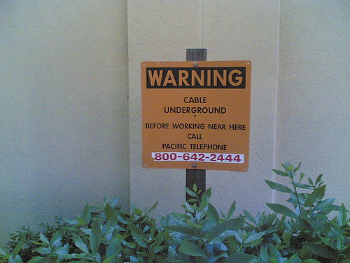
Captured this week in downtown San Jose, CA.
Will these warning signs preventing interferences disappear in the ubicomp of the future? There is probably a cultural take to it. It is not surprise that seamful design emerged in the UK. Designers have been used to warn about the limits of the infrastructure (i.e. the culturally anchored “mind the gap”) almost to the overdose. In other cultures, designers assume for the best without overloading the interfaces almost to the point of the uselessness. It will probably become important to understanding to find the right balance to notify the seams to the everyday users of the ubicomp invisible infrastructures. Might be a topic to extend to contribute to Julian Bleecker’s ‘Salon’ at Picnic’07.

