Posted: March 30th, 2008 | No Comments »
2 years after Mobilités, la Clé des Villes, JCDecaux released Les Audiences dans la Ville the second opus of their trendbook serie “cahier des tendances” that collects visions on the world of media, new technologies, urbanism and design from an eclectic crowd of practitioners and researchers. I contributed with a text on the digital traces we leave behind us from our daily frictions with urban infrastructures and services and some implications when they are processed and made public. The concept of traces Nicolas later analyzes as a support for social navigation. Other short essays include Maurice Levy predicting the emergence of the “urban media”, Adam Greenfield on Everyware, Daniel Kaplan on the city as a platform for innovation open to the co-creation between the actors of the city and the citizens, Peter Fleischer on the new opportunities the web and in the city offer people to handle their identities and topic also discussed by Frédéric Kaplan with a spin on traceability, Nathan Stern on hyperlocality, Bruno Marzloff on “ambient sociability” and the citizens appropriation of their time and space.
The content of Les Audences dans la Ville can be accessed online in its entirety.

Posted: March 30th, 2008 | No Comments »
In addition to a first list, here is list of events I won’t attend but should keep an eye upon.
First International Workshop on Trends in Pervasive and Ubiquitous Geotechnology and Geoinformation
Workshop @ the GIScience conference, September 2008, Park City, Utah, USA
The aim of the workshop is to bring together researchers from various fields to discuss trends in pervasive and ubiquitous geotechnology and geoinformation and their impact on the day-to-day application of geography by consumers and geo-friendly industries such as tourism and education. [...] In this workshop, we will discuss the issues (both human factors and engineering challenges) surrounding these context-aware systems. While we will include any research topic that relates either to geotechnology or geoinformation, we will focus on the theory behind and application of systems that successfully and rigorously combine the two. Furthermore, we will particularly highlight research that is able to combine the two in a manner that creates a value to the end user that is greater than the sum of the parts. Finally, we will also discuss broader questions related to pervasive and ubiquitous geotechnology and geoinformation. For instance, how will these new capabilities transform the way we experience the world around us? More importantly, how will they alter our interaction with geography?
The First International Workshop on Location and the Web (LocWeb 2008)
In Conjunction with the WWW 2008 Conference. April 22
This main objective of this workshop is to look into the fields of how to extract, index, mine, find, exploit, mashup, and visualize Web content with respect to its location semantics.
Space = Interaction = Discourse
Aalborg, Denmark from 12th – 14th November 2008
The aim of this conference is to bring together researchers who investigate space, mediated discourse and embodied interaction from different perspectives. The conference will highlight interdisciplinary research that explores how embodied and virtual social actors communicate, interact and coordinate their activities in complex multimodal environments, with a special focus on place, mobility and the body.
Summer Institute of the The Vespucci Initiative for the Advancement of Geographic Information Science
With a 1-week session in Tuscany, Italy on the Geo-Sensor Web with the presence of YDream’s Antonio Camara and UCSB’ Michael F. Goodchild
Geospatial information increasingly is being produced not only by central mapping agencies but by diverse and dispersed collections of sensors. How does this new data collection and dissemination paradigm affect the geospatial community, and vice versa? Sensor Web and citizen participatioon: what happens when citizens are able to deploy and exploit their own sensors? If the Sensor Web becomes as ubiquitous and successful (within its realm of influence) as the WWW, in what ways might it change the way we do things? What areas of high-inertia might be reduced? What as-of-yet unforeseen applications might emerge?
Posted: March 30th, 2008 | 1 Comment »
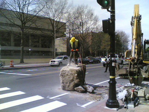
Relation to my thesis: I now ditched the argumentation on messiness, but keep enjoying observing and recording moments of sliding friction. In that sense, this week’s T5 meltdown is fascinating to follow the design, (political, physical, economical) constraints and technological failures that make this £4 billion project collapse and reconstruct the path of events/decisions that lead to this moment of messiness. Later it will be interesting to see how the overall issues get fixed and how passenger adapted and got around the failures. But that should be the content of another thesis.
Alternatively, this photo describes metaphorically the state of my current work on my thesis.
Posted: March 23rd, 2008 | No Comments »
In The Repast Simulation/Modelling System for. Geospatial Simulation, CASA’s Andrew Crooks (blog) introduces Repast and its ability to incorporate geospatial data to build an environment and to create agents to explore different types of phenomena. He shortly introduces some geosptatial simulation constructed from minimalist academic models based upon ideal assumptions, to large scale decision support systems based upon real-world data. These include:
- disaster management such as a Sarin attack in Manhattan, the spread of infectious diseases and a food poisoning outbreak
- pedestrian modelling both in retail and emergency evacuation
- urban dynamics (see Barros, J. (2004), Urban Growth in Latin American Cities: exploring urban dynamics through agent-based simulation), segregation, residential and business location
- models in which mobile agents travel and interact on rugged terrain or on network landscapes at any scale from rooms within buildings to urban neighbourhoods to large geographic networks of cities. (see GeoGraph)
- study land use change
- geographic conflict research(see GROWLab)
Relation to my thesis: Exploring the possible use of “census data” generated by digital footprints (user-generated data, cellphone data) to model urban tourism (some profiles of tourists) dynamism both in time and space. It would be one way to validate the data (compare the simulation with survey data) and test different scenarios over several cities, thus aiding planning tourism. Appetizer before reading Cities and Complexity: Understanding Cities with Cellular Automata, Agent-Based Models, and Fractals.
Posted: March 23rd, 2008 | 1 Comment »
In a talk at the Responsive City meeting, Manuel Castells discussed the practices of urban management and design in this current historic moment when 50% of the planet population now lives in cities (South America reaching 80%!). Unlike what futoroligsts predicted communication networks did not kill distances the cities have not disappeared. It lead to new form of urbanism – some call it megacities (Casstells has another word about that) or what Peter Hall and Kathryn Pain refer as Polycentric Metropolis, a cluster of cities and towns, physically separate but intensively networked in a complex spatial division of labor. These new places are represented by networks (like new england, southern california) and they do not have official names. In fact the name are defined by the news and media. For instance local news refer to the “Bay Area” in San Francisco (a region where San Jose is even bigger) and “South Land” in Los Angeles. In these cases, the television market (and how it attracts advertisement) actually defined the place.
Globalization is made of these networks. Each network has a different geographies (movie industry, knowledge production, finance). In some metropolitian areas these networks overlay (e.g. London) and synergies happen at the nodes where theses different networks connect. They form “micro-milieux” where decision making takes place. For instance, the city of Saragossa is currently being integrated to Madrid and Barceona in the same time. As Barcelona made less efforts in interconnecting, apparently Saragossa is becoming absorbed as a spatial node of Madrid.
There is not political authority over these new places (megacities). The expression of people on their major metropolitan areas (see Un point de vue unique sur la ville) reveals that they feel betrayed by their local governments because they favor the management of the flows over the management of the place. It means that the strategy to first get rich by privileging connections to the outside world (investiement in airport, optic networks, convention centers) and then we redistribute the wealth is not well perceived. Saragossa is an excellet example of these tensions between existing in the world and providing basic or good services to citizens.
Castells gives some key pointers that now must be considered in urban planning:
- connectivity is critical (multi-modal, local and global connectivity)
- speed and scale create huge environment problems. Technologies make cities grow and do not make them disappear (as also stated by Richard Florida, “the World is Spiky“. On some city maps the freeways are now drawn in green. Therefore, environmental planning should the at the foundation of planning.
- crisis of political legitimacy. citizen are more distrustful from local governament than the central authorities.
- the public physical space is really hard to maintain. Some of them, like La Rambla became a theme park where locals are not present anymore (even the mimes and entertainers are foreigners).
and a few implications in the management of these spaces:
- strengthen of the public space in each of the nucleus
- aim at congregating people with no specific purposes (serendipty) shopping centers are not public spaces. merchants streets are public spaces
- metropolitan cities are about building “stations”. For instance, the most innovative places are close to railway stations. We have to think that we must build cities around these nucleuses.
- density of population creates possibility for stores, business and life emerges (following here the Barcelona Ecologia’s concept of compact mediteranean city)
- maintain a vibrant immigrant life (letting them to be open the whole night). Like stores owned by Chinese immigrants in Spain.
- nurture the notion of distributed monumentality. Build spatial signs of recognition, otherwise people don’t know where they are. It can take the form of monumental architecture (whit the same usual suspects designing the monuments (Nouvel, Gehry, Foster, …- cities are divided by serveral architectural agencies). These monuments become signs of indifications are more important than their actual settings.
Relation to my thesis: Even though I do not focus on macro/global issues of the development of networks, I was curious to hear how a leading urban sociologist describes the hybridization of the physical and digital in the city and the type of signals he analysis and how they are transformed in implications for planning and management. From Castells’ talk, it seems that the interface with technologies and networks is still not taught in land use planning and urban design. It once again comforts my feeling that urban space will need researchers with mixed competences in engineering, HCI (call it user experience or interaction design) and urban planning, validating this year’s move to the MIT Department of Urban Studies and Planning.
In relation to the notion of “distributed monumentality” and their necessity as spatial signs of recognition, I believe that the analysis of pervasive user-generated content could reveal the monuments of the city that people use to anchor their data in the space.
“Who’s Your City?,” the world is spiky
Posted: March 22nd, 2008 | No Comments »
In the book of the New York Talk Exchange project, William Mitchell addresses in “Mapping Urban Flux” the ethical issue of analyzing digital traces to reveal the urban dynamics:
There is little doubt that the capacity to track, analyze, and map urban activity in fine-grained, real time detail will open up powerful new ways of providing services to urban inhabitants, of managing urban systems efficiently, of enhancing safety and security, and of making well-informed planning decisions.
[...]
But the crucial questions that loom here are not ones of technological feasibility. They are questions of how we will want to make some difficult social tradeoffs, how we will debate these tradeoffs, and how much power we still may have to affect them anyway.
[...]
But if this explanation does not take place within a framework of vigilant, carefully debated, vigorously formulated and executed public policy – with careful attention to issues of data aggregation and individual privacy – we will soon find that have unwittingly allowed the stealthy, piecemeal emergence of an irreversible condition of electronic hyper-visiblity.
Relation to my thesis: In my thesis I will need to discuss the ethical issues and social tradeoffs in analyzing individual and aggregated digital traces.
Posted: March 19th, 2008 | No Comments »
A brainstorm meeting at the SENSEable inspired me to draw a simplified innovation process of my research work.

It start at a design level by developing systems that senses the hybridization of the digital and the physical in the city (currently digital traces in the form of photos, interaction with bike sharing system). Then, a fast prototype visualizations to provide a quick support for visual synthesis and preliminary investigation of digital traces. This phase also contributes in stretching the limits of the data with a creative “what if” exploration that leads me to generate research questions. I address these question through methodologies that imply observation methods (mainly data-mining), modeling techniques and the validation of the data and models through second order analysis with types of data and simulation. Finally these assessed results completes a feedback loop that should inform the design of future hybrid (digital/physical) systems in city.
Posted: March 18th, 2008 | No Comments »
In Everyday Engineering, Andrew Burroughs takes an engineer’s eye toward the inherent but unheralded presence of technologies., In this pamphlet made from collection of photos and texts he describes on how ordinary objects and environments behave over time, from humble streetlights to tread-worn floors. It share a same approach as Sliding Friction: The Harmonious Jungle of Contemporary Cities.

Posted: March 17th, 2008 | 3 Comments »
In the processing of building a coherent story around my research endeavors and considering potential outcome, I have returned to exploring how agent-based modeling techniques can help grapple with the validation and significance of user-genereated content in the realm of urban/mobility/tourist research. Current tourism simulation and modeling (see for instance TourSim) works mainly rely on specific surveys to build and evaluation the simulation. In addition, the data collected describe tourist behaviour such as spending habits, and psychological motivations for tourism. These sparse information make it hard to reflect the complexities of tourist behavior and build effective and efficient decision support tools to assess planning decisions. What is required for recreation planning, is verification of how tourists act spatially at recreation sites. However key variables such as the speed of tourist travel, wayfinding decisions, crowd avoidance, and other spatial behaviour, are not yet well understood to model the tourist visiting a city. One of my hypothesis is that digital footprints such as user-generated content can help develop agent-based models and simulations of tourist flows and movements (in that case through photography).
Similar to transport research, some tourist research collect quantitative data of tourist activity such walking and photography. In Building better agents: Geo-temporal tracking and analysis of tourist behavior the authors use quantitative data captured by sensors to build agent-based models of tourist behaviors. Their simulation provide one way for managers to accurately predict future impacts, and their spatial patterns of the develop of certain tourist areas. They analyze:
- detailed visitor counts
- average trip durations
- tourist behavior
- spatial patterns of movement
in order to reveal some group and individual behaviors:
Crowding: Determing through correlation whether people were spending less time, for example, on the viewing platform, during more crowded times of the day.
Graphing: Provide detailed information about times and sequences of travel for individuals and groups
Travel time: Time frequency distribution to be analyzed. Correlation between time spent in various area of the study site
Travel sequence: Tourist behavior can be devided into distinguishable groups based on movement sequences
However, the overall validity of the simulations remains uncertain without detailed calibration data. As described in Understanding of tourist dynamics from explicitly disclosed location information, the flickr dataset can provide more coarse grained quantitative observations of similar phenomenon. However, user-generated data can surpass the scalability and time constraints of surveys and sensor-based approaches. My current believe is that the availability of data over the world’s most photographed cities can allow me to validate tourist models build from user-generated content. Building such a model and validate it with simulation over several cities might be one nice outcome.
Next steps in that direction, Michael Batty wrote a book on Cities and Complexity: Understanding Cities with Cellular Automata, Agent-Based Models, and Fractals. Repast Simphony 1.0 has recently been released which includes a point and click interface for model development and full GIS support.
Posted: March 12th, 2008 | No Comments »
In a discussion at the MIT Responsive Ctiy meeting with Prof. Nigel H.M. Wilson who presented current research in the analysis of real-time transportation data for understanding users behaviors, the question was raised to know why these data where not massively used nowadays (related to what Christopher Zegras discussed last week). Many transportation agencies still rely on expensive surveys with a limited statistical significance and overlook large automatically collected data their system provide. Nigel answered that first, these agencies want to make sure these data bring at least the same amount of knowledge than their “manual” data (e.g. surveys). Second, they do not necessarly have the skills and knowledge to analyze and grasp the significance of these data (which is my feeling when it comes to Bicing or Velib usage data). We seem to be in a chicken and egg situation here. Finally, there is a people concern that these data will be used to their detriment. For instance, it could reveal that the number of routes in certain areas should be decreased, or that user could wait longer for connexions. In other words, these data do not always lead to positive and favorable decisions for certain users.
Relation to my thesis: A major issue in leveraging people generated content to reveal new aspects of the city is about validating and proving the significance of these data with already existing analysis techniques.
