Posted: September 30th, 2008 | No Comments »
Last week at Picnic took place a session on the The Visible City that featured projects that map cellphone network activity mobility as proxy of different urban dynamics in a city. Euro Beinat Director Sensible Future Foundation revealed the Current City initiative was with an artistic animation of SMS activity in Amsterdam by designed by Aaron Koblin with the support of urban data mining star Andrea Vaccari. In addition colleague Assaf Bidermann presented the senseable city lab‘s classics (see the a recent program on Discovery Channel for a description of the motivations behind these projects).
InternetActu has a concise report on these 2 presentations (Regarde la ville vivre) that apparently briefly discussed the use of cellphone data to reveal touristic areas (a theme I touch in a paper in the upcoming issue of IEEE Pervasive Magazine). With a less subdued tone, Michiel de Lange (who organized the Mobile City conference this year) provides a very refreshing angle on the session. He argues that quantitative data reduce mobility to mere movements without meaning that does not allow to to get a sense of the city as a lived space and how it is experienced. I find a lot of sympathy in this claim that touches the limitations of hard urban data (they might reveal the “how” but barely assess the motivations of the people who produce the data) and the necessity of the qualitative angle to describe the “why”.
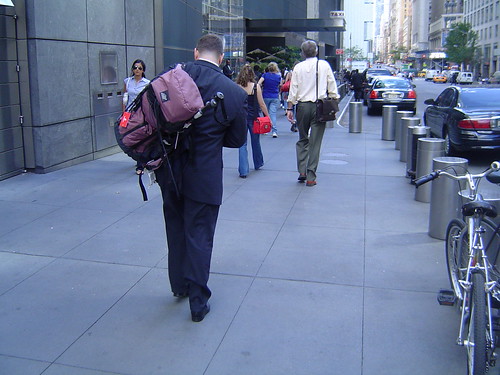
A new urban hiker in Manhattan (the day Lehman Brothers filed for Chapter 11 bankruptcy protection). Quantitative data won’t capture his divergent experience of the city that day.
Relation to my thesis: Discussing the visualization of urban digital footprints seems to be the trend this year (see also José Luis de Vicente’s interview “Visualiser pour discuter et agir” and the upcoming VISUALIZAR’08: Database City workshop he organizes). In 1 years will we actually discuss the analysis of these data and the methods to assess them? My journey as a PhD candidate will be over by then.

Apparently my work on Flickr in Barcelona has been mentioned at Picnic. Photo courtesy of cc. Kandinski
Posted: September 17th, 2008 | No Comments »
Physically anchored by some heavy urban data drilling activities, I could not make the trip to Jeju, Korea for this year’s Lift Asia. Its session on network cities discussed the fusion of digital technologies into contemporary urban environments. Fortunately Nicolas Nova and Bruno Giussani reported their notes. In a follow-up of his the City is Here for You to Use, Adam Greenfield argued that the invisible and intangible overlay of networked information that enfolds in the city is taking over the urban fabrics as drivers to our choices and actions. This becomes particularly true with a long here of layering a persistent and retrievable georeferenced histories and a big now of real-time accessibility to this information at a local and global scale (video of the talk). With the control of these two conditions, networked cities will have the capabilities to respond to the behavior of its residents and other users in like real time, underwriting the transition from browse urbanism to search urbanism. This proposal of the city “à venir” with its new new patterns of interactions echoes very well with Dan Hill’s latest The Adaptive City (follow-up of Sketching the Street of the Near-Future)
These newer nervous systems, not centralised but distributed, and predicated on digital networks of networks in which every object is informational and every movement or behaviour is trackable, could combine to form a new kind of lattice-like informational membrane, hovering magically over the physical fabric of the city. As if one of Calvino’s imaginary cities comprised solely of information, a limitless multidimensional data-based shadow structure represents the life of the city in real-time.
[...]
The built fabric becomes less important than the behaviour of the city itself, and we finally have a sense of the latter. As Reyner Banham suggested all those years ago, services and infrastructure become far more relevant to the way the city feels.
but captured realities networked information feeds back to us only partially correlates the complex reality of a city, as reported in our Real-Time Cities Round Table last Spring and highlighted by Hill:
Not all of the life, of course. There are limits to such models, as there are limits to the perceptive capabilities of sensors and of filters to interpret the data. Real life continues in parallel with the real-time city model. In an inversion of the body, where the human subconscious is capable of processing vast amounts of data not perceived by its conscious self, the real-time city model can only capture a tiny fraction of the information present within the city. So the city information model cannot approach the subconscious of the city, but can provide a facsimile of consciousness.
The model is already being built. With only the simple visualisation of data scraped from the management systems of bike-sharing networks Vélib’ and Bicing we can already see the pulse of the city, Barcelona’s bikes heading to the beach into the sun, whereas their Parisian counterparts saunter from the Périphérique inwards to the centre, mirroring the city’s intrinsic wider rhythms of work and play.
yet these mirrors of the urban reality, even slightly distorted can change the practice of designing cities and their spaces with better/cheaper metrics for post-occupancy evaluations:
Everyday design could become a conversation within social software networks, and citizens have data and tools that urban designers can only dream of. In fact, professional urban designers have this data too, and thus their practice is transformed.
Relation to my thesis: Cities’ evolutions into information spheres, generating wider set of accessible data. Their analysis create novel perspective (or stories as Hill would say) that might affect the way the city sees itself and thus behaves. Ben Cerveny provides in Models of urban dynamics his abstract Look at the way we behave in the real-time city
Yet we are still at a very early stage in which stake holders are actually still not clear on what to do with the data they have been sitting on for years (Données publicques montrez-nous une meilleure voie) and how they could be fed back in a meaningful way.
Posted: September 17th, 2008 | No Comments »
Previously accepted for publication in the Journal of Location Based Service, the paper Leveraging explicitly disclosed location information to understand tourist dynamics: a case study, co-authored with Filippo Dal Fiore and Carlo Ratti at the MIT SENSEable City Lab and Josep Blat my advisor at the Universitat Pompeu Fabra, in now available on the journal web site (Volume 2, Issue 1).
Relation to my thesis: First outcome of my collaboration with senseable. Follow-up work will be published in the upcoming issue of IEEE Pervasive Computing.
Posted: September 9th, 2008 | No Comments »
In November, I will be in Madrid to teach at this year’s VISUALIZAR workshop on “database cities”. Organized by Medialab-Prado, this series of workshop explores the social, cultural and political possibilities of the art and science of data visualization. This year, curator José Luis de Vicente set the focus on the city and its “daily generated volumes of information that requires new methods of analysis and understanding”. The introductory pitch goes as follows:
Urban environments, which are becoming increasingly dense, complex and diverse, are one of contemporary society’s largest “databases”, daily generating volumes of information that require new methods of analysis and understanding. How can we use the data visualization and information design resources to understand the processes governing contemporary cities and better manage them? What can we learn from studying traffic and pedestrian movement flows through the streets of Madrid? What would happen if we filled the streets with screens providing information updated each moment about water and electricity consumption?
For two weeks, lectures, presentations, and an intense project development programme will involve participants from all over the world in a collaborative process that will culminate in eight new proposals for the city.
There is a call for projects and a call for papers (Deadline: October 5, 2008).
Relation to my thesis: A good gig to summarize and transmit the lessons learned this year at senseable with a 1-hour lecture to provoke and days of hands-on activities to share my methods and techniques. I will share the roles of lecturer and instructor with Adam Greenfield, Juan Freire and Bestiario‘s Santiago Ortiz and Andrés Ortiz.