Posted: November 21st, 2006 | No Comments »
Where 2.0 Conference 2007 Call For Proposals is out. The conference will take place May 29-30, 2007 at the Fairmont Hotel in San Jose, California, U.S. Topics of my interest include:
Ultralocal: Bluetooth, WiFi… these are the ingredients of ultra-local applications. Utilizing this information companies like Skyhook Wireless, Microsoft, and SixthSense are able to locate you and provide services. It seems like users would want them but they haven’t taken off yet. Is the killer app around the corner or is this never going to truly take off?
Mobile: Location-based services are increasingly being added to mobile phones. What will the next innovations be and where will they come from? Handset manufacturers? Carriers? Or a startup who outflanks both of them?
Visualization: Google Earth and Sketchup. Frappr. Windows Spaceland. These tools have turned us all into voyeurs and neogeographers. What are the advances in this area?
Wild Cards: There are also some wild cards in the geospace. Virtual worlds are currently fun and being used for experiments. Will they eventually become more than just geodata playgrounds? Does Microsoft’s Spaceland count as a virtual world? What rights do property-owners have over how their physical property are represented virtually? Games. People play games to explore their world, but in doing so they can be exposed to new technology. What are the latest advances in location-based gaming? How is it changing people’s perceptions?
Where Fair: For the third year in a row, Where 2.0 will bring forward the location aware tools, apps and hardware being created in garages and university labs for the Where Fair. The Where Fair is a hands-on, science fair style event where the creators of these location based projects can share their emerging location technology with others. Are you or do you know someone working on a cool location based project that would wow and amaze at the Where Fair?
Relation to my thesis: I might just do the trip this year…
Posted: November 20th, 2006 | No Comments »
In Mike Kuniavsky inspires himself from PARC’s inch/foot/yard scale to come up with a user-centered hierarchy for which we can design and then assign a term to. :
If you look at the articles in the Ubicomp conference proceedings, you’ll find them dominated by location sensing and tracking. Clearly, ubicomp is still about figuring where you are in a space. But what happens when you’ve done that? What happens to designing the user experience when you know location?
[...]
My goal is to create a user-centered hierarchy (rather than hardware-centric) as a way of talking about the perceived effects of ubiquitous computing technologies. In other words, this is an attempt to talk (roughly) about end users’ radius of focus in the moment as a way to design for that moment.
In his Granularities of User Experience in Ubicomp, Mike focuses on the tangible and more physical aspect of ubicomp. My work has a similar user-centered approach on how ubiquitous technologies are perceived and how to design according to their granularity. One of my research question is “how certain do positional and tracking systems have to be in order to be useful and acceptable?”. Today, I ran a small experiment on Flickr’s map service. Each geotagged image has a related accuracy representing the level of granularity in which the user located the image on the map. Results show my and my contact’s use of the accuracy.

My use of “accuracy” in Flickr’s geotagging service

The use of “accuracy” by my contacts
Relation to my thesis: Investigating the use of granularity in spatial annotation, being inspired by Mike’s Granularities of User Experience.
Posted: November 17th, 2006 | 7 Comments »
Loopt, a mobile social mapping (i.e. spatial annotation and buddy finder) application, won the Under the Radar’s Overall Audience Choice Winner.
Loopt show you where your friends are by automatically updating maps on your mobile handset. loopt also lets you send messages to nearby friends or receive automatic alerts when they’re nearby so that you never miss an opportunity to meet.

Relation to my thesis: Fascinated by the popular demand of social mapping mobile application with the current failed-state of LBS. Similar to WaveMarket (2.5 years ago), Navizon, Plazes, Meetro, and Jaiku.
Posted: November 17th, 2006 | No Comments »
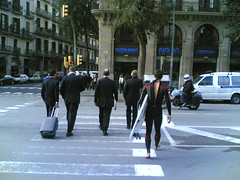
Lunchtime for a urban surfer in Barcelona today. Made me think of BCN Ecologia’s concept of Compact Mediterranean City.
Posted: November 16th, 2006 | No Comments »
Histories de Barcelona acts a bit like a spatial city blog. It allows citizens to annotate the map of Barcelona with their stories categorized in topics such as love, fiction, historic, daily life. More than a 1000 geolocated stories have been written so far. With “Accessible Barcelona” it is the second Barcelona-based spatial annotation service that highlighting the non-perceivable aspects of the city.

JOSEP, IT IS LATER THAN 3:00am
Relation to my thesis: I am fascinated by the implicit aspects of a city. The daily very visible that yet resides in the background of our attention. Engaging spatial annotation scenarios that “make the implicit explicit” could be used as one context for my thesis… or not.
Posted: November 14th, 2006 | No Comments »
Avanzit announced the availability for 2007 to track kids, Alzheimer patient, dogs, cars and so on. Coined by El Pais as the Tranqulizor the device (a flat card) developed by Navento pretends of a positioning accuracy of 1m with GPS and a long-lasting battery. It can be embedded into a mobile phone. If not, I am not sure how the data are transmitted to a central server (supposedly via GSM module).
The tracked persons or artifacts can be monitored from a online map. When coverage is lost, the device is located with the position of its last signal. Dot are used to represent the movement; red if continuous, blue if slow and yellow if stopped.
The service should be available worldwide, with a starting price of 100EUR. The press release.

Via Daniel Kaplan
Relation to my thesis: Engineers gone wild. It is not the first tracking system used on kids or animals (e.g. dogs and caddles), assets, objects and fleets. However, the use cases of this service described by Avanzit’s representatives are rather stunning:
“Se puede utilizar a través del móvil o del ordenador y tener multitud de usos: por ejemplo, con él se podría defender a las mujeres maltratadas de sus agresores”
It can be used via a mobile phone or a computer and have multiple uses: For example, mistreated women could defend themselves from their aggressors.
“El Ejército de EE UU, por ejemplo, que a veces no sabe dónde no tiene sus armas y tanques en Irak, podría conocer la posición exacta de su armamento con esta tecnología”
The US army in Irak, for example, could know the exact position of the weapons and tanks they often lose.
Posted: November 13th, 2006 | No Comments »
On a side academic project, I am investigation of visualization techniques of recommendation for lifelong competence development programs. Two issues relate to my research interests and could be evaluated in parallel with my real-world field studies.
- Use a map metaphor to position a learner in a competence landscape and support his/her awareness and navigation.
- There is an inherent uncertainty in the recommendations (the algorithm is a black box). Visualizing the quality/accuracy of the recommendations could improve the usability of the tool.

A type of map that could support users to define competences to acquire. (Example of Search queries in 2003 in the swiss search engine search.ch. Source Schweizer Cyberlandschaft, produced by the University of Zürich Sotomo group)
Relation to my thesis: Usability studies or experiments on positioning in the information space could (eventually) support my “living lab“-based field studies.
Posted: November 12th, 2006 | 9 Comments »

My PhD research plan has been validated. The current title of my thesis is: “Designing location-aware systems that manage discrepancies between the sensed physical world and its virtual representation“, but it surely will evolve. I summarize my research as follow:
Advances in mobile technologies allowed the emergence of a quantity of applications taking advantage of location. The uses of Location-Aware Systems (LAS) range from car and pedestrian navigation, finding and tracking a person, a group or an artifact, targeted marketing, local search, to the virtual annotation of the physical space (e.g. geotagging and geoblogging). However, most mobile, distributed systems and sensor technologies that deliver location information to these applications have their faults and limitations. These shortcomings create challenges for the designers and users of LAS to successfully use the contextual information promised by such technologies.
This proposal emerges from early work that shows that the uncertainties inherent to location-sensing technologies affect the usability of ubiquitous systems. It stresses on the importance of integrating the limitations of positioning technologies in a real-world use of a large-scale location-aware system.
We aim at answering the challenges enhancing the usability of a location-aware system by handling uncertainty inherent to ubiquitous technologies. Consequently we will investigate how certain a location-aware system should be in terms of location quality, location timeliness and evaluate design strategies to manage sptail uncertainty. We formulate our research question as “How to build a location-aware system that enhances its usability by handling uncertainty inherent to ubiquitous computing technologies?”. To answer it, we will rely on a classical design-science research method with an innovation building approach. We expect the outcomes of this thesis to be in the form of methods (i.e. a set of guidelines to use to manage uncertainty in LAS in order to enhance their usability) and instantiations (i.e. the realization of a real-world LAS that uses guidelines to manage spatial uncertainty).
For that purpose, we plan to use an iterative process to design location-aware mobile platform. We will hence use participatory design and fast prototyping techniques in each iterative phase of the project. The platform will provide a context for series of field studies in which we will evaluate design strategies to integrate the discrepancies of the sensed physical world and its virtual representation
Relation to my thesis: end of first year 
Posted: November 11th, 2006 | No Comments »
At the Ubiquitous Computing, Entertainment and Games workshop organized by Julian Bleecker at UbiComp2005, Benjamin Joffe of Newt Games presented the field results of Mogi-Mogi and some ideas on ubiquity. On slide talk to provide what is meaningful when it come to dealing with location.

Acadmic papers on Mogi include:
“Seing” one another onscreen and the construction of social order in mobile-based augmented public space and Etude Ethnographique de Développement d’un MMORPG Mobile.
Relation to my thesis: Mogi is a very rare example of design strategies for real-time location-aware system that have been evaluated with 1000+ players.
Posted: November 11th, 2006 | No Comments »
After the 30s Vision of Mobile Computing, the NEC PC-8200 portable computer ad called “NEC reinvents the office”.

The future looked great indeed!
Via angermann2
Relation to my thesis: A keeper for this year Interface design lab on contextual design


