Posted: May 9th, 2006 | No Comments »
Leonhardi, A. and Rothermel, K. 2001. A Comparison of Protocols for Updating Location Information. Cluster Computing 4, 4 (Oct. 2001), 355-367.
The location of information may be acquired by different types of sensor systems and therefore has different degree of accuracy. The transmission of location information can use different update protocols:
In case of a querying protocol the information is pulled by the receiver, while with a reporting protocol it is pushed by the sender. A combined protocol is also possible, where an optimal ratio between the number of updates and the number of queries has to be found.
The different types of querying protocols are:
Simple: the location information is queried from the source each time it is queried by the an application
Cached: the server stores a cached copy of the last transmitted location information
Periodic: the server queries the location information periodically from the source with a certain time interval D
The different types of reporting protocols are (the initiative is on the side of the source):
Simple: the source sends the location information each time the value has changed
Time-based: The location information is transmitted periodically after a certain interval of time T has elapsed
Distance-based: sends an update of the location information whenever the geographic distance between the current location and the last reported location becomes greater than a given threshold D.
Location and uncertainty model
A location sighting can have a temporal as well as a spatial accuracy. The temporal accuracy is given by the time that has elapsed since the location sighting has been acquired, while the spatial accuracy is de ned by the maximum distance between the position reported by the sighting and the actual position of the mobile object. For many location-aware applications the spatial accuracy of a sighting is more important, because the applications are concerned with the spatial relationship between (mobile) objects. The uncertainty ul(t) of a certain location sighting l describes the spatial accuracy at a given time t > tl.
At the time of the sighting the uncertainty is determined by the accuracy up of the sensor system. The uncertainty at a later time t can be estimated by the distance the mobile object may have traveled during the time t – tl. If a maximum bound for the velocity of the mobile object (vmax) exists, the maximum uncertainty of the location sighting can be calculated by adding the distance the object can have traveled to the uncertainty of the sensor system (see Figure 4). This is described by the following equation:


Tracking systems vs. positioning systems
The location information for a mobile object can be determined through various types of positioning systems. A basic distinction can be made between tracking systems, where a system of stationary sensors determines the location of a mobile object, and positioning systems, where the location information is determined by a sensor on the mobile object itself.
Disconnection and uncertainty
A common characteristic of these wireless networks is that a connection can be temporarily lost while the device is at an unfavorable location (e.g., inside of a tunnel), a state which is called a disconnection. In most cases a wireless network can also not o er as good a bandwidth and latency as a fixed networks (see [Sat96]).
In the following paragraphs we discuss the properties of the basic protocols with regard to disconnections, namely how long it takes to detect a disconnection and the maximum uncertainty of the location information returned during that time.
Location service functionalities
The location service shall provide the following functionality: It will support range queries, that is finding all mobile objects inside a given area, as well as position queries, which request the current location of a certain mobile object.
Relation to my thesis: Update protocols for location information can be used to reduce (or at least scope) uncertainty on the location timeliness. Catchbob! uses a time-based reporting protocol. On idea is to mix this protocols with others and have an adaptive approach depending on the connectivity and the stage of the game. I could also let the users choose their update algorithms and see their needs to change them. My try to contextualize update protocols in spatial uncertainty:

Posted: May 9th, 2006 | 1 Comment »

This centurey will be connected, monitored and smoke free… or won’t be. I am wondering when these signs will become default and therefore disappear.
Related: Deficient WiFi Awareness Sign
Posted: May 8th, 2006 | No Comments »

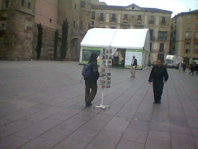
A guy dragging along with him a postcard holder in the Barcelona tourist area. Mobile sale?
Posted: May 8th, 2006 | No Comments »

Energy sale on the streets of Barcelona. The guy’s offer was “8 alkaline batteries for 1EUR”. A post peak oil scenario with an energy black market and people selling on the street?
Posted: May 7th, 2006 | No Comments »
UbiComp 2006 will have an open session, chaired by Lars Erik Holmquist and Barry Brown and Gregory Abowd.
The UbiComp Open Session welcomes controversial ideas, novel prototypes, failed but valuable user studies, bold experiments, and anything else that can give a fresh perspective on ubiquitous computing, ambient intelligence, information appliances, smart artefacts and mobile applications.
The UbiComp Open Session is:
- Open format: everything can be submitted, everything will be considered
- Open reviewing: reviews and discussions will take place publicly on-line and non-anonymously
- Open presentations: traditional paper presentations are fully acceptable, but if you want to build a system from scratch, perform a stand-up comedy routine, run a live demo, organize an audience participation event, or anything else, feel free!
- Open for business: come and join us at UbiComp 2006!
Related to my thesis: appealing venue to meet fellow party poopers and freaks.
Posted: May 7th, 2006 | 1 Comment »
Pang A. Visualizing uncertainty in geo-spatial data. In: Workshop on the Intersections between Geospatial Information and Information Technology, prepared for the National Academies committee of the Computer Science and Telecomm unifications Board, 2001.
Abstract: This paper focuses on how computer graphics and visualization can help users access and understand the increasing volume of geo-spatial data. In particular, this paper highlights some of the visualization challenges in visualizing uncertainty associated with geo-spatial data. Uncertainty comes in a variety of forms and representations, and require different techniques for presentation together with the underlying data. In general, treating the uncertainty values as additional variables of a multivariate data set is not always the best approach. We present some possible approaches and further challenges using two illustrative application domains.
As these components become more affordable and widespread (e.g. GeoSensor/Dust Networks), and as the volume and richness of geo-spatial data set being collected increase, the need for visualizing these data in an informative and consistent manner become more acute. In particular, there will inevitably be more concern about the accuracy, timeliness, and confidence of information being displayed – specially if the data are coming from multiple sources, or by their nature of collection contain some inherent uncertainty.
Depending on the domain, uncertainty can be associated with variability, but also sparsity in data, uncertainty in the model. It can arise from measurements, registration, and calibration operations, but also from processing of the data themselves. Uncertainty my be represented in different ways such as scalar, intervals, tuples, or distributions at each geo-spatial coordinate. Different visualization techniques must be developed to present these uncertainty representations together with the underlying data.
There is not consensus or universally recognized meaning for uncertainty in the literature. Uncertainty is a multi-face characterization about data, whether from measurements and observations of some phenomenon, and predictions made from them. It may include several concepts including error, accuracy, precision, validity, quality, variability, noise, completeness, confidence, and reliability.
It try to model (in process) the different components of spatial uncertainty

A definition of spatial uncertainty
In [1], spatial uncertainty is defined for both attribute values and position. It includes accuracy, statistical precision and bias in initial values, as well as in estimated predictive coefficients in statistically calibrated equations used in the analysis. “Most importantly, spatial uncertainty includes the estimation of errors in the final output that result from the propagation of external (initial values) uncertainty and internal (model) uncertainty.”
Visualization challenge
Uncertainty is an important issue with geospatial data sets, and hence it is not surprising to see a large number of papers from related fields such as geography and cartography. There is more than one way to classify how uncertainty can be visualized. One is by how uncertainty itself is represented, another is by how uncertainty is encoded into visualization. For the latter, there are two general ways of combining uncertainty into a visualization:
- mapping uncertainty information as an additional piece of data. Incorporating uncertainty information into the visualization by mapping it as transparency, haze, blur, etc. to alter the appearance of the underlying data.
- creating new visualization primitives and abstractions that incorporate uncertainty information. Modifying the visualization primitive itself so that uncertainty can be encoded with the data, and usually in such a way that the interpretation of both data and uncertainty cannot be visually separated.

Relation to my thesis: The source of data uncertainty are source errors, process errors and use errors [2]. In many cases uncertainty in geo-spatial data is as important as the data itself. My research focuses on how best to communicate uncertainty information accurately and effectively. This papers offers a state of the art on visualization techniques that treat uncertainty as an integral element with the data. I am deeply interested in how spatial uncertainty is handled in traditional domains such as geography and cartography. Other fields with works similar to my interests are information visualization [1] [2] (displaying uncertainty), artificial intelligence (reducing uncertainty), robotics (wayfinding with uncertainty), psychology (coping/dealing with uncertainty, spatial cognition), and complexity theory (contextualizing uncertainty).
References to read:
[1] H. T. Mowrer and R.G. Congalton, editors. Quantifying Spatial Uncertainty in Natural Resources: Theory and Applications for GIS and Remote Sensing. Ann Arbor Press, 2000.
[2] M. Kate Beard, Barbara P. Buttenfield, and Sarah B. Clapham. NCGIA research initiative 7: Visualization of spatial data quality. Technical Paper 91-26, National Center for Geographic Information and Analysis, October 1991. Available through ftp: ncgia.ucsb.edu. 59pp.
Posted: May 6th, 2006 | No Comments »
hang, M., & Goodman, E. (2004, April). Fiasco: Location-based, physical gameplay with a digital interface. Paper presented at Pervasive 2004 Workshop on Gaming Applications in Pervasive Computing Environments, Vienna.
As pervasive gaming moves into the public sphere, the authors propose a review of their effects on social life and urban spaces.
Relation to my thesis: Getting a perspective on the integration of pervasive game in everyday world. One challenge is to manage this integration by avoiding unwanted intrusion/transformation in our daily lives.
Posted: May 6th, 2006 | No Comments »
Kalle Jegers, Mikael Wiberg, “Pervasive Gaming in the Everyday World,” IEEE Pervasive Computing, vol. 5, no. 1, pp. 78-85, Jan-Mar, 2006.
SupaFly is a everyday-world pervasive game used in this empirical study that examine the reality of pervasive gaming.
The intend of pervasive is to be played anytime and anywhere. However this study shows that players did not play in a mobile fashion (changing locations and contexts) but in a rather immobile way in their home. They also played the game mainly at evenings and nights at home during their leisure time.
The authors plan a longitudinal, ethnographical approach to address the following question in an everyday life context:
- In what situations do people choose to enter the game?
- Do people play alone or when they get together?
- Is there any learning effect (for example, do people internalize the SMS commands over time)?
- Does the cost of sending SMS messages create a barrier to long-term playing of the game?
Relation to my thesis: Pervasive games offer often advanced platforms to study how users deal with spatial uncertainty. Interestingly now pervasive game are moving away from controlled settings and entering everyday world. However players barely took advantage of the offered place-independence. Moreover, it is still unclear whether location is sufficient to successfully integrate the physical and virtual world. Location matters… hmm well… yes but….
Posted: May 6th, 2006 | No Comments »
Schwabe, G., Göth, C. (2005): “Navigating and interacting indoors with a mobile learning game“, International Workshop on Wireless and Mobile Technologies in Education.
This paper focuses on the design of a mobile learning game to experience immersion. It discusses height implications resulted from three trials performed in 2004 and 2005.

Design recommendation 4 deals with visual imprecision of location information appropriately.
Dealing with imprecise location information: Indoor navigation requires a higher precision than outdoor navigation. The Ekahau system provides positioning information with a reliable accuracy of 3-5m. The effect of the limited accuracy is amplified by information delays. [...] Thus there is an important design issue how to present the imprecise location information to the user. For physical reasons, the location error of the Ekahau engine is not linear.
Design solutions depend on activities:
- Navigation to another location: Here it is most important to indicate the precision of the location information to the users.
- Solving a task: An appropriate design answer is an automatic or manual locking of location information while a participant is solving a task. If a task requires local movements beyond the precision of the W-LAN positioning system, changing to a Personal Area Location Information system with active digital objects is advisable.
Relation to my thesis: Valuable implications for design for location-based application (beyond games) and how to deal with imprecise location information in the context of mobility.
Posted: May 6th, 2006 | No Comments »
Sohn, T., Li, K., Lee, G., Smith, I., Scott, J., Griswold, W. (2005). Place-Its: Location-Based Reminders on Mobile Phones. Proc. Intl. Conf. on Ubiquitous Computing, 232–250.
Place-Its is a location-based reminder application that runs on mobile phones. The aim is to find how location-based reminders are used when available throughout a person’s day as well as how important is positional accuracy and timelines to the usefulness of location-based reminders. This study reveals that location-based reminders are useful. In large because people use location in nuances ways. The study participants found location-based reminders to be useful, despite relatively low accuracy.
More significantly, the other six participants said the location algorithm used by Place-Its was sometimes not accurate enough for their reminders. The participants would get the reminder, but not necessarily at the right location. This degree of this perception lessened over time as the participants adapted their behaviors.
Due to the way location-based reminders were used and the relative inaccuracy of location-sensing in Place-Its, we cannot claim location itself is essential context, even as we find it to be useful for triggering reminders. More than anything, its ready availability admits opportunistic use by those who can map their relevant (but un-sensed) context to anticipated, coarse, location cues.
Relation to my thesis: Even with coarse location-sensing capabilities, the application was found useful. However, location was widely used as a cue for other contextual information. Did the users adapted their reminders to the limitations of the location-sensing application?