Mobile Postcard Holder
Posted: May 8th, 2006 | No Comments »
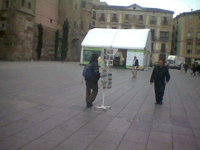
A guy dragging along with him a postcard holder in the Barcelona tourist area. Mobile sale?
A guy dragging along with him a postcard holder in the Barcelona tourist area. Mobile sale?
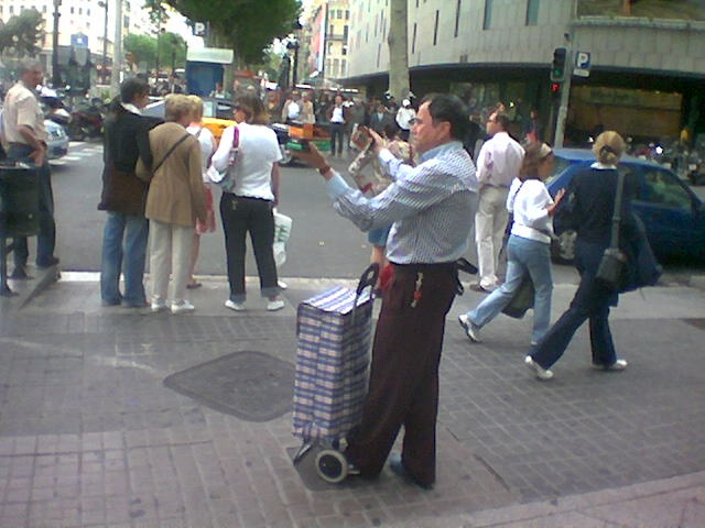
Energy sale on the streets of Barcelona. The guy’s offer was “8 alkaline batteries for 1EUR”. A post peak oil scenario with an energy black market and people selling on the street?
UbiComp 2006 will have an open session, chaired by Lars Erik Holmquist and Barry Brown and Gregory Abowd.
The UbiComp Open Session welcomes controversial ideas, novel prototypes, failed but valuable user studies, bold experiments, and anything else that can give a fresh perspective on ubiquitous computing, ambient intelligence, information appliances, smart artefacts and mobile applications.
The UbiComp Open Session is:
Related to my thesis: appealing venue to meet fellow party poopers and freaks.
Pang A. Visualizing uncertainty in geo-spatial data. In: Workshop on the Intersections between Geospatial Information and Information Technology, prepared for the National Academies committee of the Computer Science and Telecomm unifications Board, 2001.
Abstract: This paper focuses on how computer graphics and visualization can help users access and understand the increasing volume of geo-spatial data. In particular, this paper highlights some of the visualization challenges in visualizing uncertainty associated with geo-spatial data. Uncertainty comes in a variety of forms and representations, and require different techniques for presentation together with the underlying data. In general, treating the uncertainty values as additional variables of a multivariate data set is not always the best approach. We present some possible approaches and further challenges using two illustrative application domains.
As these components become more affordable and widespread (e.g. GeoSensor/Dust Networks), and as the volume and richness of geo-spatial data set being collected increase, the need for visualizing these data in an informative and consistent manner become more acute. In particular, there will inevitably be more concern about the accuracy, timeliness, and confidence of information being displayed – specially if the data are coming from multiple sources, or by their nature of collection contain some inherent uncertainty.
Depending on the domain, uncertainty can be associated with variability, but also sparsity in data, uncertainty in the model. It can arise from measurements, registration, and calibration operations, but also from processing of the data themselves. Uncertainty my be represented in different ways such as scalar, intervals, tuples, or distributions at each geo-spatial coordinate. Different visualization techniques must be developed to present these uncertainty representations together with the underlying data.
There is not consensus or universally recognized meaning for uncertainty in the literature. Uncertainty is a multi-face characterization about data, whether from measurements and observations of some phenomenon, and predictions made from them. It may include several concepts including error, accuracy, precision, validity, quality, variability, noise, completeness, confidence, and reliability.
It try to model (in process) the different components of spatial uncertainty

A definition of spatial uncertainty
In [1], spatial uncertainty is defined for both attribute values and position. It includes accuracy, statistical precision and bias in initial values, as well as in estimated predictive coefficients in statistically calibrated equations used in the analysis. “Most importantly, spatial uncertainty includes the estimation of errors in the final output that result from the propagation of external (initial values) uncertainty and internal (model) uncertainty.”
Visualization challenge
Uncertainty is an important issue with geospatial data sets, and hence it is not surprising to see a large number of papers from related fields such as geography and cartography. There is more than one way to classify how uncertainty can be visualized. One is by how uncertainty itself is represented, another is by how uncertainty is encoded into visualization. For the latter, there are two general ways of combining uncertainty into a visualization:

Relation to my thesis: The source of data uncertainty are source errors, process errors and use errors [2]. In many cases uncertainty in geo-spatial data is as important as the data itself. My research focuses on how best to communicate uncertainty information accurately and effectively. This papers offers a state of the art on visualization techniques that treat uncertainty as an integral element with the data. I am deeply interested in how spatial uncertainty is handled in traditional domains such as geography and cartography. Other fields with works similar to my interests are information visualization [1] [2] (displaying uncertainty), artificial intelligence (reducing uncertainty), robotics (wayfinding with uncertainty), psychology (coping/dealing with uncertainty, spatial cognition), and complexity theory (contextualizing uncertainty).
References to read:
[1] H. T. Mowrer and R.G. Congalton, editors. Quantifying Spatial Uncertainty in Natural Resources: Theory and Applications for GIS and Remote Sensing. Ann Arbor Press, 2000.
[2] M. Kate Beard, Barbara P. Buttenfield, and Sarah B. Clapham. NCGIA research initiative 7: Visualization of spatial data quality. Technical Paper 91-26, National Center for Geographic Information and Analysis, October 1991. Available through ftp: ncgia.ucsb.edu. 59pp.
hang, M., & Goodman, E. (2004, April). Fiasco: Location-based, physical gameplay with a digital interface. Paper presented at Pervasive 2004 Workshop on Gaming Applications in Pervasive Computing Environments, Vienna.
As pervasive gaming moves into the public sphere, the authors propose a review of their effects on social life and urban spaces.
Relation to my thesis: Getting a perspective on the integration of pervasive game in everyday world. One challenge is to manage this integration by avoiding unwanted intrusion/transformation in our daily lives.
Kalle Jegers, Mikael Wiberg, “Pervasive Gaming in the Everyday World,” IEEE Pervasive Computing, vol. 5, no. 1, pp. 78-85, Jan-Mar, 2006.
SupaFly is a everyday-world pervasive game used in this empirical study that examine the reality of pervasive gaming.
The intend of pervasive is to be played anytime and anywhere. However this study shows that players did not play in a mobile fashion (changing locations and contexts) but in a rather immobile way in their home. They also played the game mainly at evenings and nights at home during their leisure time.
The authors plan a longitudinal, ethnographical approach to address the following question in an everyday life context:
Relation to my thesis: Pervasive games offer often advanced platforms to study how users deal with spatial uncertainty. Interestingly now pervasive game are moving away from controlled settings and entering everyday world. However players barely took advantage of the offered place-independence. Moreover, it is still unclear whether location is sufficient to successfully integrate the physical and virtual world. Location matters… hmm well… yes but….
Schwabe, G., Göth, C. (2005): “Navigating and interacting indoors with a mobile learning game“, International Workshop on Wireless and Mobile Technologies in Education.
This paper focuses on the design of a mobile learning game to experience immersion. It discusses height implications resulted from three trials performed in 2004 and 2005.

Design recommendation 4 deals with visual imprecision of location information appropriately.
Dealing with imprecise location information: Indoor navigation requires a higher precision than outdoor navigation. The Ekahau system provides positioning information with a reliable accuracy of 3-5m. The effect of the limited accuracy is amplified by information delays. [...] Thus there is an important design issue how to present the imprecise location information to the user. For physical reasons, the location error of the Ekahau engine is not linear.
Design solutions depend on activities:
Relation to my thesis: Valuable implications for design for location-based application (beyond games) and how to deal with imprecise location information in the context of mobility.
Sohn, T., Li, K., Lee, G., Smith, I., Scott, J., Griswold, W. (2005). Place-Its: Location-Based Reminders on Mobile Phones. Proc. Intl. Conf. on Ubiquitous Computing, 232–250.
Place-Its is a location-based reminder application that runs on mobile phones. The aim is to find how location-based reminders are used when available throughout a person’s day as well as how important is positional accuracy and timelines to the usefulness of location-based reminders. This study reveals that location-based reminders are useful. In large because people use location in nuances ways. The study participants found location-based reminders to be useful, despite relatively low accuracy.
More significantly, the other six participants said the location algorithm used by Place-Its was sometimes not accurate enough for their reminders. The participants would get the reminder, but not necessarily at the right location. This degree of this perception lessened over time as the participants adapted their behaviors.
Due to the way location-based reminders were used and the relative inaccuracy of location-sensing in Place-Its, we cannot claim location itself is essential context, even as we find it to be useful for triggering reminders. More than anything, its ready availability admits opportunistic use by those who can map their relevant (but un-sensed) context to anticipated, coarse, location cues.
Relation to my thesis: Even with coarse location-sensing capabilities, the application was found useful. However, location was widely used as a cue for other contextual information. Did the users adapted their reminders to the limitations of the location-sensing application?
Google has begun testing his Wi-Fi cloud over Mountain View and has discovered it might need to add more Wi-Fi transmitters than originally thought to deliver the coverage and service quality it promised.
A few weeks ago, in extension to my Deficient WiFi Awareness Sign, Riad Lemhachheche provided a good insight on the high expectations of San Francisco citywide Wi-Fi coverage (95% outdoor and 90% indoor). In large scale Wi-Fi is hard to plan and highly unpredictable. As Riad puts it:
Wireless signals are much more likely to suffer interferences and this is especially true for Wi-Fi which operates in an unlicensed frequency range.
Therefore Earthlink/Google downgraded the expectations in their proposal
It is difficult in practice to achieve 90 to 100% indoor coverage with any wireless network above the second floor or for interior rooms. (p 63)
It will be interesting to see how citizens will cope with a patchy coverage. Earthlink/Google have already a “get what you pay for” type of answer for this issue:
Cellular systems are a good example, and users have already become accustomed to moving around to find a good signal for such services. (p. 63)
Relation to my thesis: Sources of spatial uncertainty are network connectivity and latency.
Gaver, B., Beaver, J. and Benford, S. Ambiguity as a resource for design. in Bellotti, V., Erickson, T., et al. eds. Proceedings of CHI 2003, Ft. Lauderdale, Florida, ACM Press, New York, NY, 2003.
In HCI ambiguity is often perceived as the nemesis of usefulness and usability. Instead of regarding ambiguity as a problem, the authors suggest that it can be sees as an opportunity in the context of emerging application for everyday life (alternatives to task-oriented forms of ubiquitous computing). Indeed, ambiguity can make a virtue out of technical limitations by providing the grounds for peoples interpretations to supplement them.
Ambiguity is an attribute of the interpretation of fuzziness or inconsistency. Things themselves are not inherently ambiguous. However, they may give rise to multiple interpretations depending on their precision, consistency and accuracy on the one hand, and the identity, motivations, and expectations of an interpreter on the other.
The authors distinguish three principal kinds of ambiguity: ambiguity of information, of context and of relationship. Ambiguity of information is of prior interest with my focus on spatial uncertainty. Gaver et al. provide an example of Bystander, a mixed reality game in which mobile player’s location is tracked using GPS data, which is prone to errors:
Thus the issue is not ‘What does this display mean?’ but ‘Do I trust it?’ – that is, how does the display correspond with reality?
The traditional response to ambiguity of information in interactive systems like Bystander is to improve the technology, use statistical methods to set certainty thresholds, or ignore it and hope for the best. Bystander, in contrast, passes the ambiguity directly to players in the form of fuzzy avatars that hint at locations without specifying them. Rather than seeing uncertain GPS information (in this instance) as a flaw, Bystander treats this ambiguous information as a challenge to users, forcing them to join their knowledge of people and cities to the clues offered by the system to play the game.
There a different tactics to use ambiguity and compel people to join in the work of making sense of a system and its context:
Exposing inconsistency between sources of information (e.g. external sensors) can also be a powerful alternative to trying to resolve or hide it. For instance, just as the uncertainties of GPS tracking in Bystander are shown to participants, so are inconsistencies revealed between GPS and spoken information. By crafting the inherent limitations of the technology into the user experience, they become a means to heighten narrative intrigue by opening a space of possibilities that participants must navigate.
Relation to my thesis: The traditional response to ambiguity of information is to improve the technology. Enhancing ambiguity of information is a design tactic is a step beyond seamful design, because it challenges the users to participate in making meaning. It focuses on creating or reflecting uncertainties about information that are noticeable to people. In my context, I try to understand how uses can cope with inaccurate sensors, inexact mappings and low-resolution displays. Encouraging them to supplement uncertainties with their own interpretations and beliefs raises questions on in what context and how much workload can we transfer to the users. How much transfer can be imposed and how much can be suggested? Nevertheless, I share the approach of using ambiguity to leverage immersion in the task while keeping a certain independence (doubt) to the system.