Posted: July 19th, 2007 | 3 Comments »
IEEE Pervasive Computing special issue on Urban Computing is out. The guest editors Tim Kindberg, Matthew Chalmers, and Eric Paulos define urban computing as “the integration of computing, sensing, and actuation technologies in everyday urban settings and lifestyles“. The urban space is a recent ground of investigation because it poses many specific research and deployment challenges: as ownership issues are complex as are the dynamics and density of system participation. Successful integration requires taking several facets of the environment into account at once. Urban settings frame social behaviors. They encompass architectural forms and features that might not be harmonious with given technologies, and they’re variably permeated by wireless networks and fixed and mobile devices.
Urban computing research is still at an early stage with a wide range of opportunities. They range from understanding urban appropriation of pervasive technologies, to producing fully integrated designs specifically for urban settings, and taking advantage of the deployed technologies to augment the understanding of the urban environment. My contribution (in collaboration with Nicolas) to this issue lies in the last category. We briefly describe as a Work in Progress the Tracing the Visitor’s Eye project in which we collect Flickr photos to reveal the movements of people in cities.


Tracing the Visitor’s Eye in Rome
Relation to my thesis: Urban computing is an emerging research avenue at the crossroad of ubiquitous computing and HCI. Definitively a sweet spot of my research focus.
Posted: July 17th, 2007 | 2 Comments »
My work-in-progress submission entitled “Place this Photo on a Map: A Study of Explicit Disclosure of Location Information” has been accepted to the 9th International Conference on Ubiquitous Computing, 16-19 September 2007, Innsbruck, Austria.
Abstract. This paper reports on the early results from an ongoing study of the use of popular photo-sharing platform. We specifically focus our investigation on the factors influencing the accuracy users choose to link their photos to the physical world. We believe that modeling these mechanism can impact the design of ubiquitous systems that support sharing and retrieval of location-enhance information. For instance, it could suggest guidelines to match people’s expectations of granularity in location information. Our early results reveal that while familiarity with a place does not seem to influence the accuracy of the disclosed location, the city and type of urban landscape impact the use of coarse and fine-grained location information.

The reviewers’ feedback are positive about the pertinence of this work and the approach. They mention “relevant to ubicomp”, “the concepts and the writing are generally good”, “the problem is important and the early findings are interesting”, “good problem formulation and research methodology”, “the authors have taken the proper first steps by looking at a real-world data set”. However, they question the early analysis:
- I concentrate on how people tag, rather than what is actually done with those tags. So I won’t be able to know about the usefulness of granularity.
- More depth analysis and logic should be supplied to make the Barcelona results believable.
- Application of arbitrary boundaries (why 2 months to seperate between resident and tourists. I could have let the categories emerge.
- Why familiarity with the environment was the only metrics chosen.
- Some more depth to the results, even in a few more sentences
- The results might be strongly tied to Flickr, thus I need to validate the findings by cross-checking different platforms.
Relation to my thesis: A final extended abstract to help me validate Tracing the Visitor’s Eye.
Posted: July 13th, 2007 | No Comments »
Posted: July 5th, 2007 | 3 Comments »
News views using the statistical and graphical tool R for my Tracing the Visitor’s Eye project:
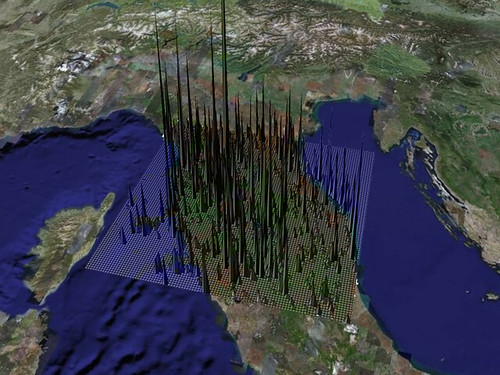
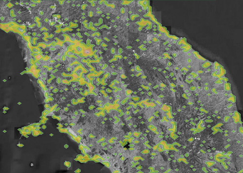
Relation to my thesis: I am developing a spatio-temporal data analysis tool to study how people use location (e.g. the information granularity) and location-aware applications (managing the uncertainty). I work with R to lose the dependance to GeoIQ and GeoCommons. They have been nice platform to quickly work on proof of concepts, but I know need a greater control on the algorithms I select. Next steps would be to replace Google Earth with an integration of Processing and the InfoScope
Posted: July 4th, 2007 | No Comments »
In Web 2.0 and beyond – changing the map, anywhere, any device Eamon Walsh describes the basic concept of ICING of providing two-way communications between the citizen and government. The facilities developed in ICING include reporting on issues such as uncollected garbage, or just opinions positive or negative on new parks, etc; collating all this data, analyzing it, and reporting it back to the public, such as in “City Affection Maps”.
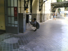
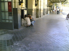
There are similar, more humble, projects to provide the ability for citizens to locate the problems they face in their daily lives. For instance, Innaccessible Barcelona provide physical impaired persons with a mobile phones to photograph every obstacle they come across or FixMyStreet, let people report problems with the street system around where they live. Those are rather compelling scenarios. However, very little (or no) platforms with location as source of communication have reached a scale exceeding a limited amount of citizen (to the exception of platial?). Despite the lack of success, there are still major projects such as ICING or WikiCity that partially assume that spatial annotation is a natural process for a citizen. Moreover, there are limited reports describing the failed studies of spatial annotation. The only one I am familiar was presented at this year’s CHI Mapmover: a case study of design-oriented research into collective expression and constructed publics. More analysis of failures might help revealing the driving factors that would make citizens annotate their city and therefore create engaging location-based systems.


Poetically dumped mattresses located with FixMyStreet (left) and providing evidences of accessibility issues of a store in Barcelona (right).
Relation to my thesis: Observing the emerging applications based on location and location technologies in urban environments and wondering about the factors that can engage citizen to attach information to a location. (+ embracing the constant repair state of a city)
Posted: July 4th, 2007 | No Comments »
After the Economist in March in “Go With the Flow“, this weekend the French newspaper Le Monde published almost a full page on the Massachusetts Institute of Technology SENSEable City Lab Real Time Rome project “Nous savons combien vous êtes !” while the BBC news covered the current lab WikiCity project in “Beating congestion with mobiles“.
Relation to my thesis: I will join this fun group of cool cats for my 3rd year of PhD.
Posted: June 29th, 2007 | No Comments »
I like to introduce Plazes to highlight the importance of granularity in to communicate the timeliness and quality of location information.

The now classic slide on “Location information granularity” with the Geneva airport in the Rhone river and me at the train station (while I took the screenshot in another city)
I might have to update my slides. The new version of Plazes came up with a “My World” view that (I think) has some intentions to take into consideration the granularity in space of the “trazes” I left recently. Drawing a circle is an obvious way to communicate the uncertainty in the location sighting (as modeled by Leonhardi and Rothermel).

No recollection of a trip to the midwest…
Relation to my thesis: Collecting example of visualization location information granularity
Posted: June 29th, 2007 | No Comments »
Barcelona counts several spars flow sensors deployed on the city bike trails.
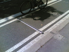
A bike counter in Barcelona
So far these data have been kept by urban planners away from the people who actually produce them. The emergence of “web of data” platforms such as freebase and geocommons offer the opportunity to use a new kind of urban data. I mentioned in a previous talk, using these systems to cross-linking official data with (explicit and implicit) citizen-generated digital footprints might produce an awareness on the pulse of a city valuable to both city planners and citizens (e.g. “my pulse in the city”).

New sources of urban data
Relation to my thesis: Thinking on new sources of urban spatio-temporal data and how to deliver (with their imperfections) a global and individualized awareness to their “producers”,
Posted: June 19th, 2007 | 1 Comment »
As part of the In-Car Computing Research led at the Mixed Reality Lab Nick Forbes performed a study on in-vehicle navigation system usage and driving behavior patterns. This works has some outcomes related to my current ethno study of taxi drivers’ use of navigation system:
Types of navigation system usage
Passive navigation system usage: the system mainly provides a sense of orientation and situation awareness.
Active navigation system usage: can be defined as occasions where the destination is entered. The system may provide routing advice, turn by turn guidance and traffic information.
Navigation mode and familiarity with environment
Previous research has shown that although navigation system users frequently use their systems in an active manner when travelling in unfamiliar environments, there is a clear tendency to use the system actively less frequently when travelling in familiar environments (where drivers have the benefit of local knowledge).
Navigation mode and familiarity with the system
The results also suggest a tendency for novice navigation system users to utilise full system functionality more often than experts while travelling in unfamiliar environments.
Maps and complacency
Only 15% of participants thought that routing instructions generated by their navigation systems were always completely reliable.
A follow-up longitudinal diary-based study should provide more qualitative and contextualized data.
via the Map Room
Less scientific, but still revealing to the study of in-vehicule navigation system usage, GPS Review reports on the large gaps in expectations of GPS devices from people shopping for GPS devices (a source of the social-technical gap in location-aware computing):
What I was most amazed about was how quickly their expectations of the device went from pure amazement of the moving map and being bewildered by the fact that the GPS has side streets to disappointment that not every POI was in the database and road changes just completed a few months before were not yet in the database.
Relation to my thesis: This work first provides some key references in psychology, hci and traffic and transportation I was definitively lacking. Then, previous works in that field seem to mainly rely on quantitative survey-based data. I see a niche to come up with in sitiu ethnographic observations that could bring other perspective to the domains of system usage, familiarity with the environment and familiarity wit the system. Moreover, the recalling mechanism might be easier for the user while being in the context of usage.
Posted: June 11th, 2007 | No Comments »
Slides (without notes) of a 1-hour lecture on the Contemporary Research in HCI I gave to students of the UPF Master Program in Information, Communication and Audiovisual Media Technologies. First, I briefly introduced the raison d’être of research in HCI, the methods applied in the field and the growing pains. Then, I categorized the current research areas by clustering the many paper tracks from this year’s CHI. The idea was to show the variety of the themes and exemplify the eclectic approaches in 4 arbitrarily picked tracks. I presented Y! Research’s work on understanding tagging behaviors, my research proposal in location-aware systems, Nicolas Ducheneaut‘s study of online gaming communities and the latest surface computing buzz (to reveal the importance of HCI research to balance with such technological breakthrough). I could have picked many other examples, but I intended to focus on the type of research that show a direct impact to design from the problem statement to the “product”. Finally, I mentioned a couple of themes (selfishly close to my interests) that might raise more attention in the future: the design for everyware, human-robot interaction and corporate ethnography.

Relation to my thesis: a healthy and fun to do exercise to describe my domain.

